Map of Brookfield, Wisconsin
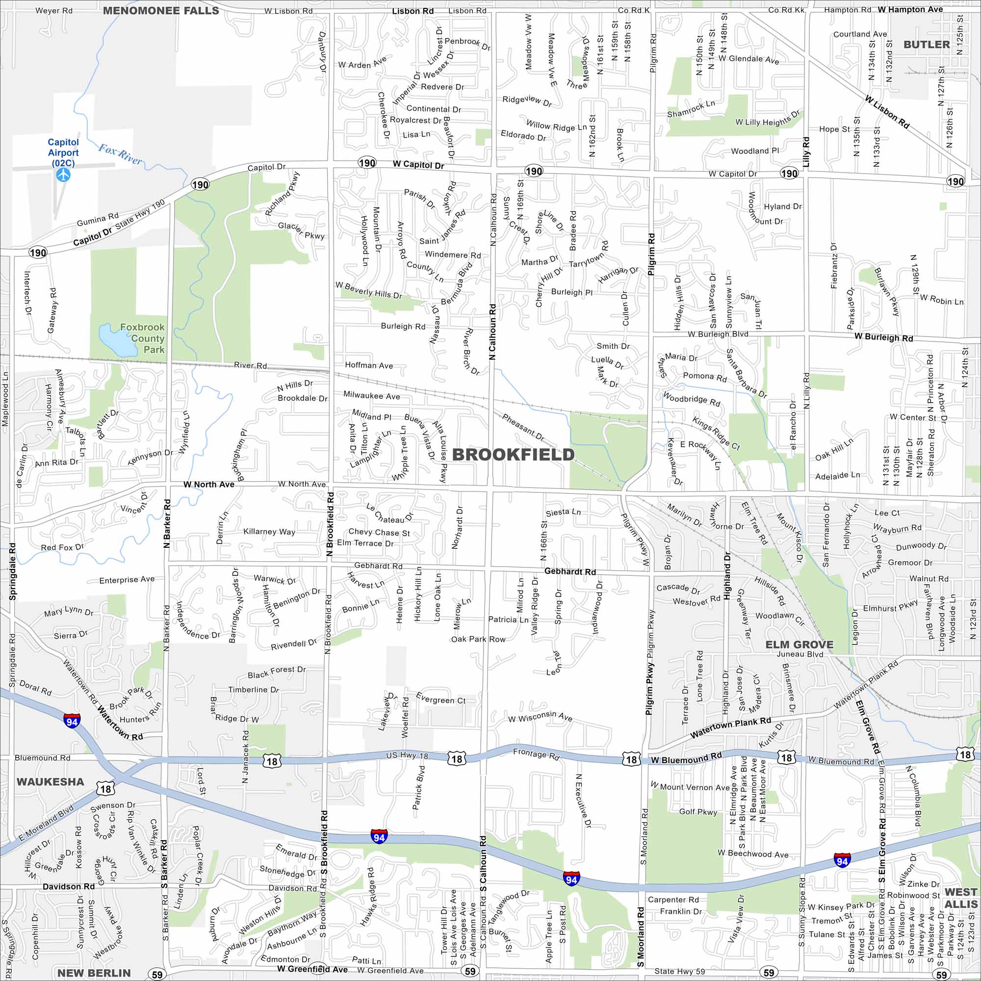
Our map of Brookfield highlights its highways, roads and parks. Green space spreads along its edges. It’s a western suburb of Milwaukee with its own identity.
Map Information
On the Map
Interstates/Highways: I-94, US Hwy 18, US Hwy 45, State Rte 190, State Rte 59 Major Roads: Capitol Dr, Bluemound Rd, North Ave, Greenfield Ave, Calhoun Rd, Moorland Rd, Barker Rd, Brookfield Rd, Pilgrim Rd, Lilly Rd, Burleigh Rd, Lisbon Rd, Wisconsin Ave, Gebhardt Rd, Watertown Plank Rd, Davidson Rd, Gumina Rd, Enterprise Ave, Golf Pkwy, River Rd Airports: Capitol Airport Lakes and Reservoirs: Fox River Parks and Preserves: Foxbrook County Park Nearby Communities: Menomonee Falls, Butler, Elm Grove, West Allis, New Berlin, WaukeshaWisconsin State Maps
Discover maps of the Badger State.


City Maps of Wisconsin
See our Wisconsin maps designed for clarity.


