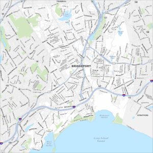
Map of Bridgeport, Connecticut
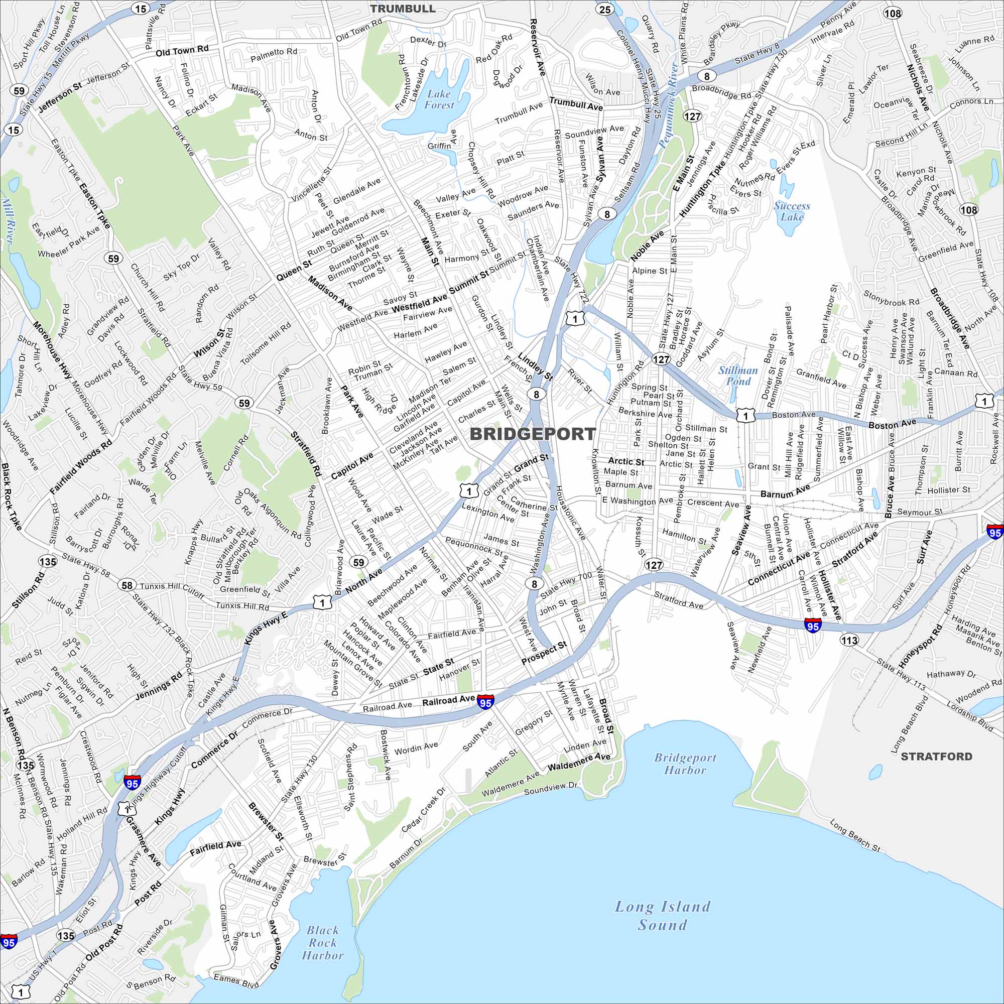
Our map of Bridgeport highlights its spot on Long Island Sound. Industry once defined the city, but parks and waterfront access give it balance. It remains Connecticut’s largest city.
Connecticut State Maps
Here’s your getaway to Connecticut geography


Map Information
On the Map
Interstates/Highways: I-95, State Rte 8, State Rte 25, State Rte 15, US Hwy 1 Major Roads: Main St, Boston Ave, North Ave, Fairfield Ave, Stratford Ave, Connecticut Ave, Madison Ave, Park Ave, Noble Ave, Capitol Ave, Lindley St, Broad St, State St, Huntington Tpke, Old Town Rd, Chopsey Hill Rd, Reservoir Ave, Sylvan Ave, Island Brook Ave, Central Ave Lakes and Reservoirs: Long Island Sound, Bridgeport Harbor, Black Rock Harbor, Lake Forest, Success Lake, Stillman Pond, Bunnell Pond, Island Brook Reservoir Major Rivers: Pequonnock River, Mill River Nearby Communities: Stratford, TrumbullConnecticut City Maps
Browse Hartford and Connecticut’s city centers