Map of Brea, California
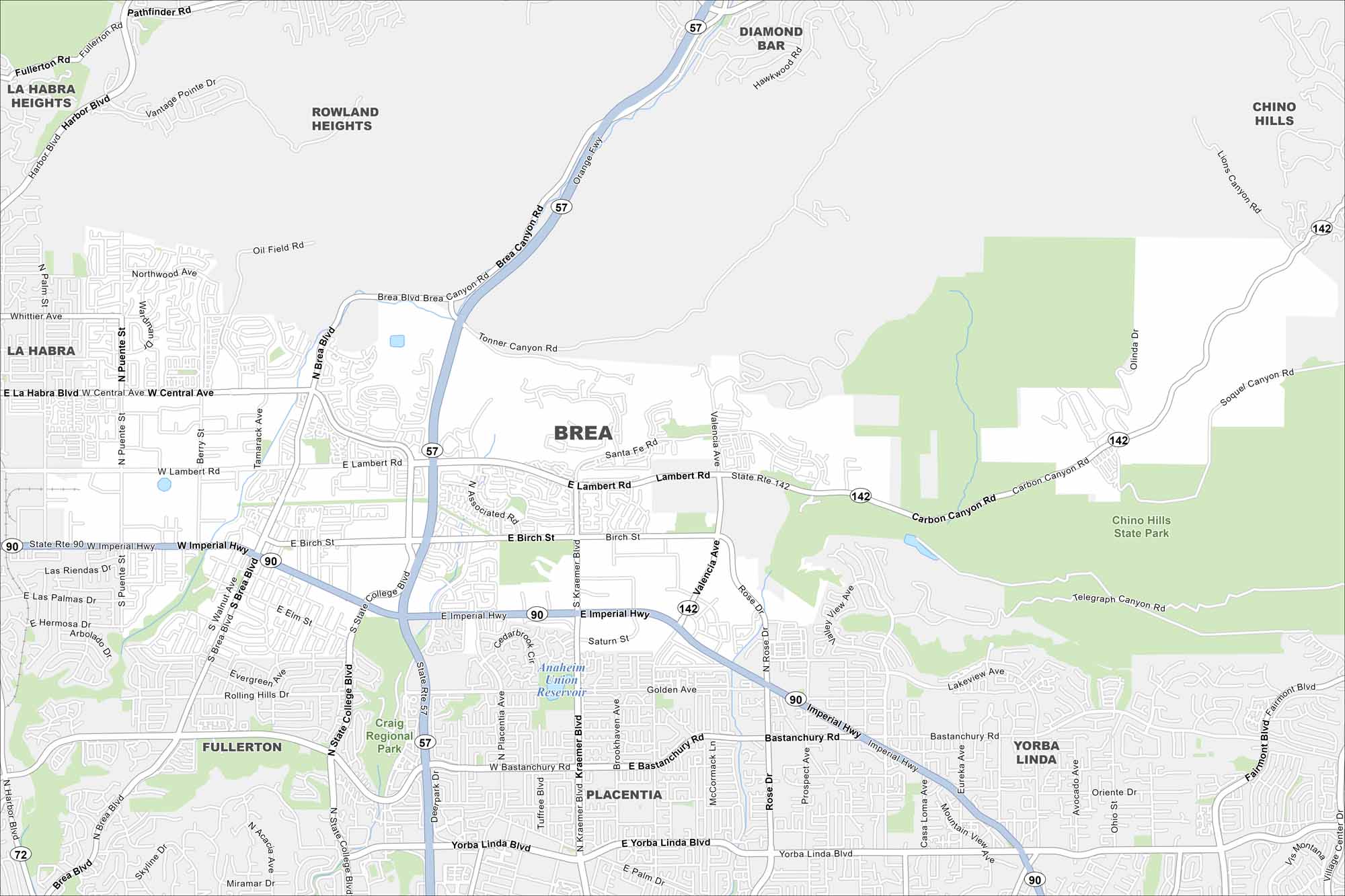
Explore Brea on our map in northern Orange County. The city is built around Chino Hills State Park with parks and trails throughout.
California State Maps
Explore California with our state maps


Map Information
On the Map
Interstates/Highways: State Rte 142, State Rte 90 Major Roads: Imperial Hwy, Brea Blvd, Lambert Rd, Carbon Canyon Rd, Valencia Ave, Bastanchury Rd, Yorba Linda Blvd, Birch St, Central Ave, Whittier Ave, Rose Dr, Kraemer Blvd, State College Blvd, Associated Rd, Olinda Dr, Kraemer Blvd, Kraemer Ave, Placentia Ave, Palm Dr, Fairmont Blvd Lakes and Reservoirs: Anaheim Union Reservoir Parks and Preserves: Chino Hills State Park, Craig Regional Park Nearby Communities: Fullerton, Placentia, Yorba Linda, Diamond Bar, Chino Hills, Rowland Heights, La Habra, La Habra HeightsCalifornia City Maps
Here are detailed maps of California


