Map of Bartlett, Tennessee
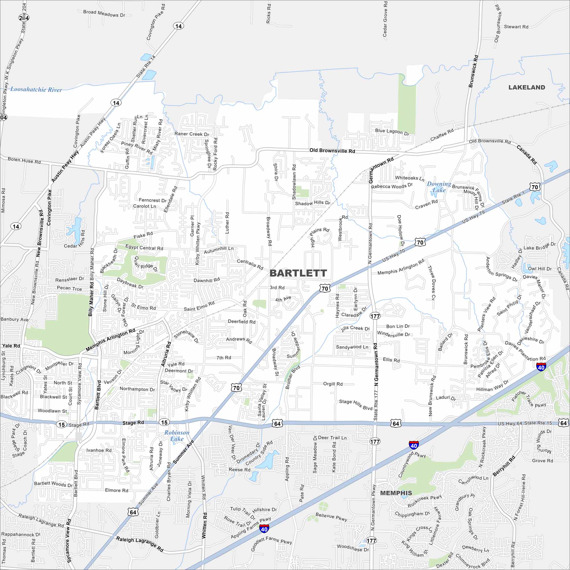
Get to know Bartlett, Tennessee. Find its main roads of this Tennessee community. Bartlett is just northeast of Memphis in Shelby County. Our map shows its parks, waterways and connecting highways.
Map Information
On the Map
Interstates/Highways: I-40, US Hwy 70, US Hwy 79, US Hwy 64, State Rte 14, State Rte 1, State Rte 15, State Rte 204, State Rte 177 Major Roads: Stage Rd, Memphis Arlington Rd, Germantown Rd, Covington Pike, Austin Peay Hwy, Kirby Whitten Rd, Whitten Rd, Brunswick Rd, Old Brownsville Rd, Appling Rd, Billy Maher Rd, Bartlett Blvd, Summer Ave, Raleigh Lagrange Rd, Yale Rd, Egypt Central Rd, Brother Blvd, Sycamore View Rd, Canada Rd, Ellis Rd Lakes and Reservoirs: Downing Lake, Robinson Lake Major Rivers: Loosahatchie River Nearby Communities: Memphis, LakelandTennessee State Maps
Here are our state maps of Tennessee.


City Maps of Tennessee
Explore our Tennessee map collection


