Map of Bakersfield, California
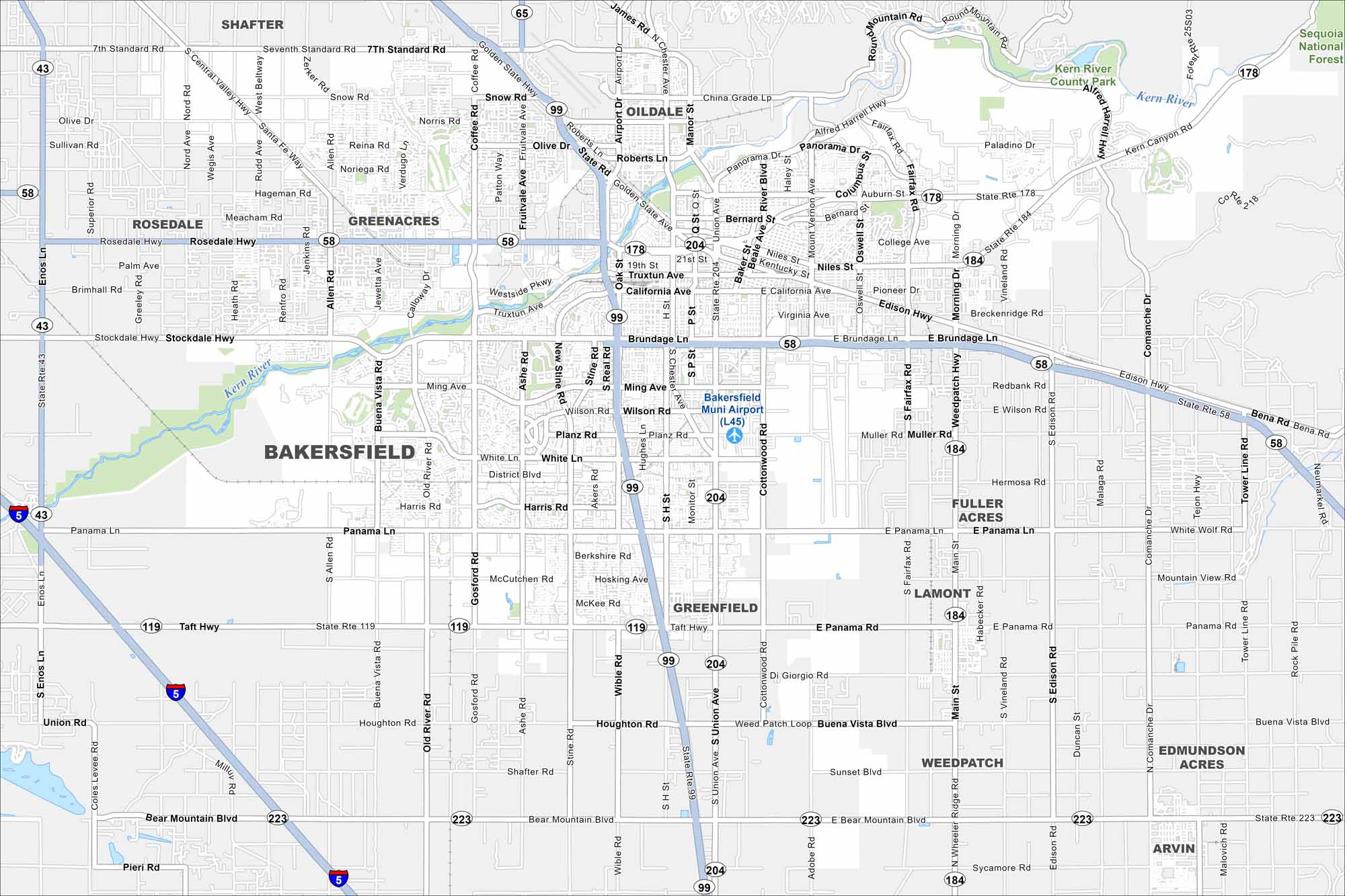
Our map of Bakersfield shows the highways, streets, and rivers. Roads spread wide because the city sits in the southern San Joaquin Valley. Bakersfield is known for oil, agriculture, and country music roots.
California State Maps
Explore California with our state maps


Map Information
On the Map
Interstates/Highways: I-5, State Rte 99, State Rte 58, State Rte 178, State Rte 43, State Rte 119, State Rte 223, State Rte 184, State Rte 65, State Rte 204, Stockdale Hwy, Rosedale Hwy Major Roads: Panama Ln, Taft Hwy, Bear Mountain Blvd, Seventh Standard Rd, White Ln, Ming Ave, Brundage Ln, California Ave, Truxtun Ave, Buena Vista Blvd, Hosking Ave, Harris Rd, Coffee Rd, Gosford Rd, Old River Rd, Fairfax Rd, Weedpatch Hwy, Edison Hwy Airports: Bakersfield Muni Airport (L45) Major Rivers: Kern River Parks and Preserves: Sequoia National Forest, Kern River County Park Nearby Communities: Oildale, Rosedale, Greenacres, Shafter, Greenfield, Fuller Acres, Lamont, Weedpatch, Arvin, Edmundson AcresCalifornia City Maps
Here are detailed maps of California


