Map of Arcadia, California
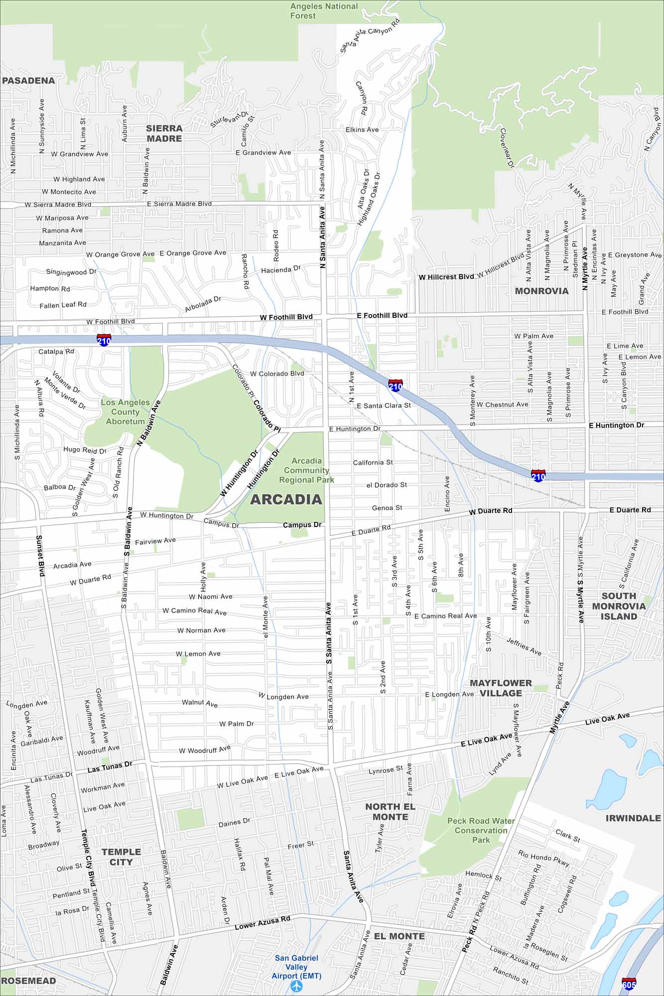
Our map of Arcadia shows the waterways, Interstate 210, and nearby mountain edges. Roads connect it toward Pasadena. The city sits along Angeles National Forest. Arcadia has Santa Anita Park and the Arboretum.
California State Maps
Explore California with our state maps


Map Information
On the Map
Interstates/Highways: I-210, I-605 Major Roads: Huntington Dr, Foothill Blvd, Santa Anita Ave, Baldwin Ave, Rosemead Blvd, Live Oak Ave, Duarte Rd, Colorado Blvd, Las Tunas Dr, Lower Azusa Rd, Peck Rd, Myrtle Ave, Sierra Madre Blvd, Orange Grove Ave, Hillcrest Blvd, Grandview Ave, Michillinda Ave, El Monte Ave, Tyler Ave, Temple City Blvd Airports: San Gabriel Valley Airport (EMT) Parks and Preserves: Angeles National Forest, Los Angeles County Arboretum, Arcadia Community Regional Park, Peck Road Water Conservation Park Nearby Communities: Pasadena, Sierra Madre, Monrovia, South Monrovia Island, Mayflower Village, North El Monte, El Monte, Temple City, Rosemead, IrwindaleCalifornia City Maps
Here are detailed maps of California


