Map of Anaheim, California
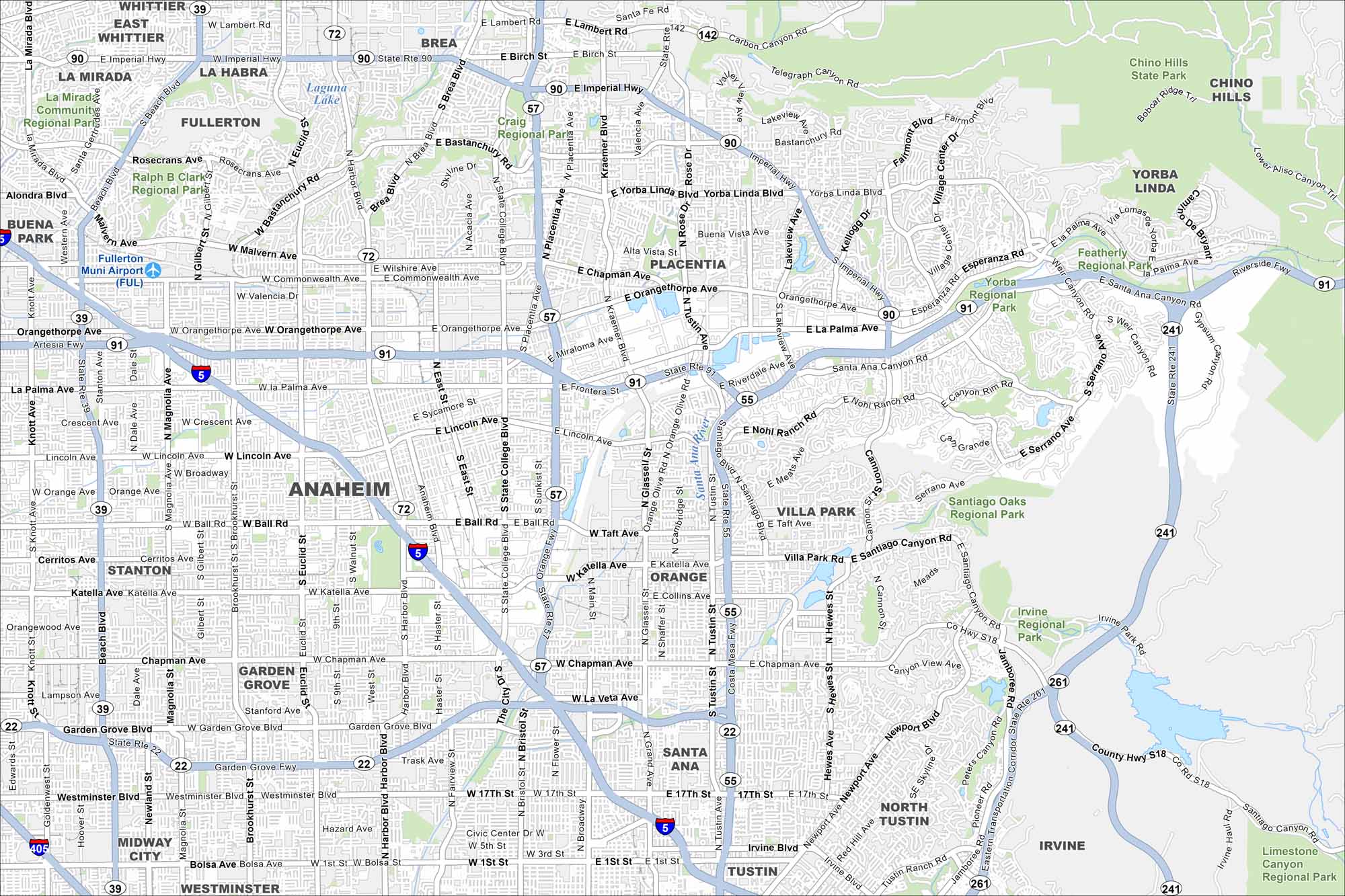
Anaheim is pure Southern California energy. It has wide highways, packed streets, and plenty of landmarks on our map. Disneyland is here but the city has a growing food and sports scene too.
California State Maps
Explore California with our state maps


Map Information
On the Map
Interstates/Highways: I-5, I-405, State Rte 91, State Rte 57, State Rte 55, State Rte 22, State Rte 90, State Rte 39, State Rte 72, State Rte 142, State Rte 241, State Rte 261, Riverside Fwy, Garden Grove Fwy, Costa Mesa Fwy, Orange Fwy, Santa Ana Fwy, Artesia Fwy, Imperial Hwy Major Roads: Katella Ave, Harbor Blvd, Chapman Ave, Ball Rd, Euclid St, Lincoln Ave, Brookhurst St, Magnolia Ave, State College Blvd, Tustin Ave, Bastanchury Rd, Orangethorpe Ave, La Palma Ave, Yorba Linda Blvd, Glassell St, Main St, Westminster Blvd, Garden Grove Blvd, Broadway, Grand Ave Airports: Fullerton Muni Airport (FUL) Lakes and Reservoirs: Laguna Lake Major Rivers: Santa Ana River Parks and Preserves: Chino Hills State Park, Santiago Oaks Regional Park, Irvine Regional Park, Yorba Regional Park, Featherly Regional Park, Craig Regional Park, Ralph B Clark Regional Park, La Mirada Community Regional Park, Villa Park Rd, Limestone Canyon Regional Park Nearby Communities: Fullerton, Placentia, Orange, Garden Grove, Stanton, Yorba Linda, Brea, La Habra, East Whittier, La Mirada, Buena Park, Villa Park, Santa Ana, Tustin, North Tustin, Irvine, Chino Hills, Midway City, WestminsterCalifornia City Maps
Here are detailed maps of California


