Map of Alameda, California
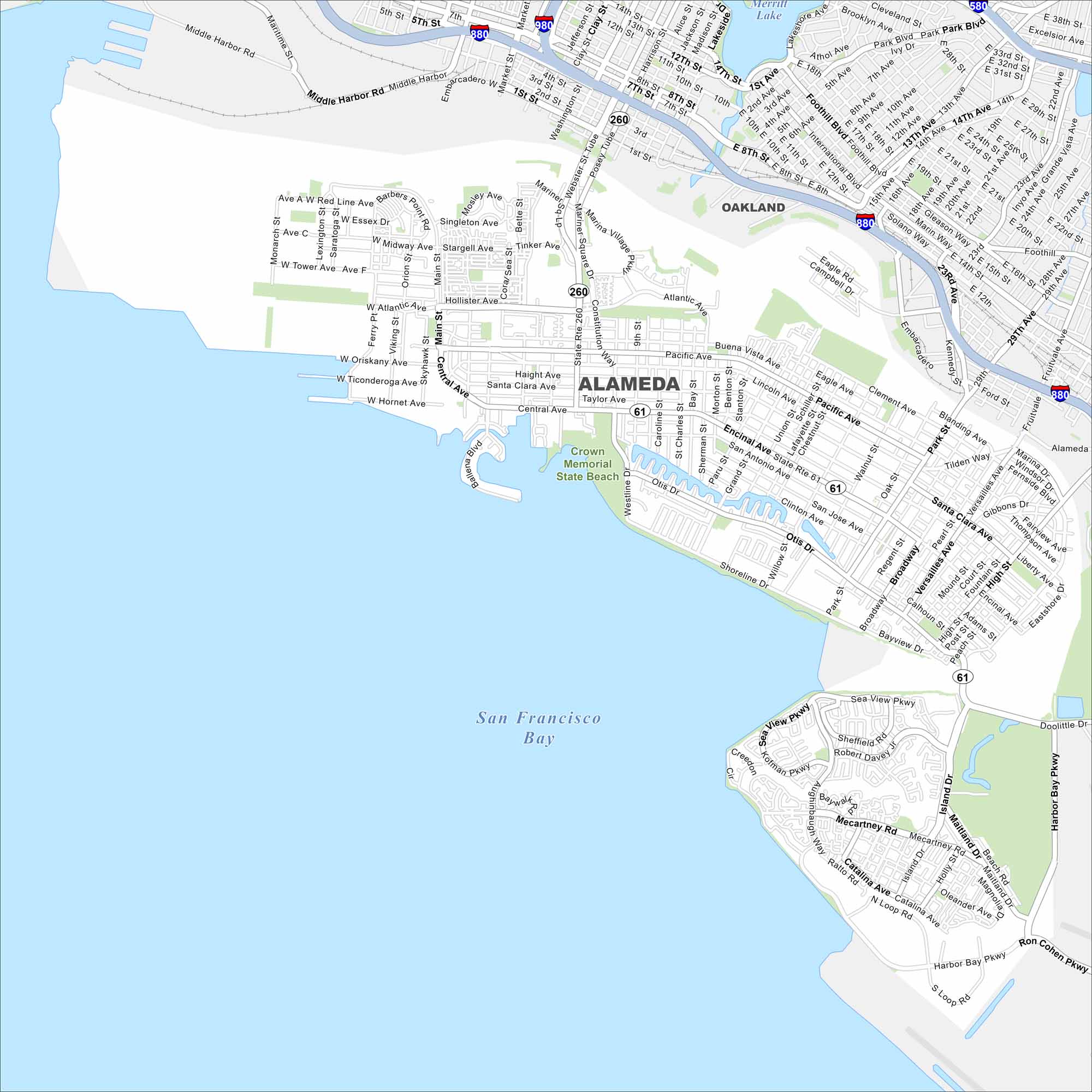
Alameda sits on an island across the bay from Oakland, with bridges and tunnels connecting it. Our map highlights its shoreline and highways. Naval history and beaches are key features here.
California State Maps
Explore California with our state maps


Map Information
On the Map
Interstates/Highways: I-880, I-980, State Rte 260, State Rte 61 Major Roads: Central Ave, Webster St, Atlantic Ave, Constitution Way, Main St, Broadway, Otis Dr, Encinal Ave, Santa Clara Ave, Shoreline Dr, Harbor Bay Pkwy, Fernside Blvd, High St, Pacific Ave, Mecartney Rd, Tilden Way, Ralph Appezzato Memorial Pkwy, Island Dr, Maitland Dr, Doolittle Dr Bays and Lakes: San Francisco Bay, Merritt Lake Parks/Preserves/Forests: Crown Memorial State Beach Nearby Communities: OaklandCalifornia City Maps
Here are detailed maps of California


