Map of Agoura Hills, California
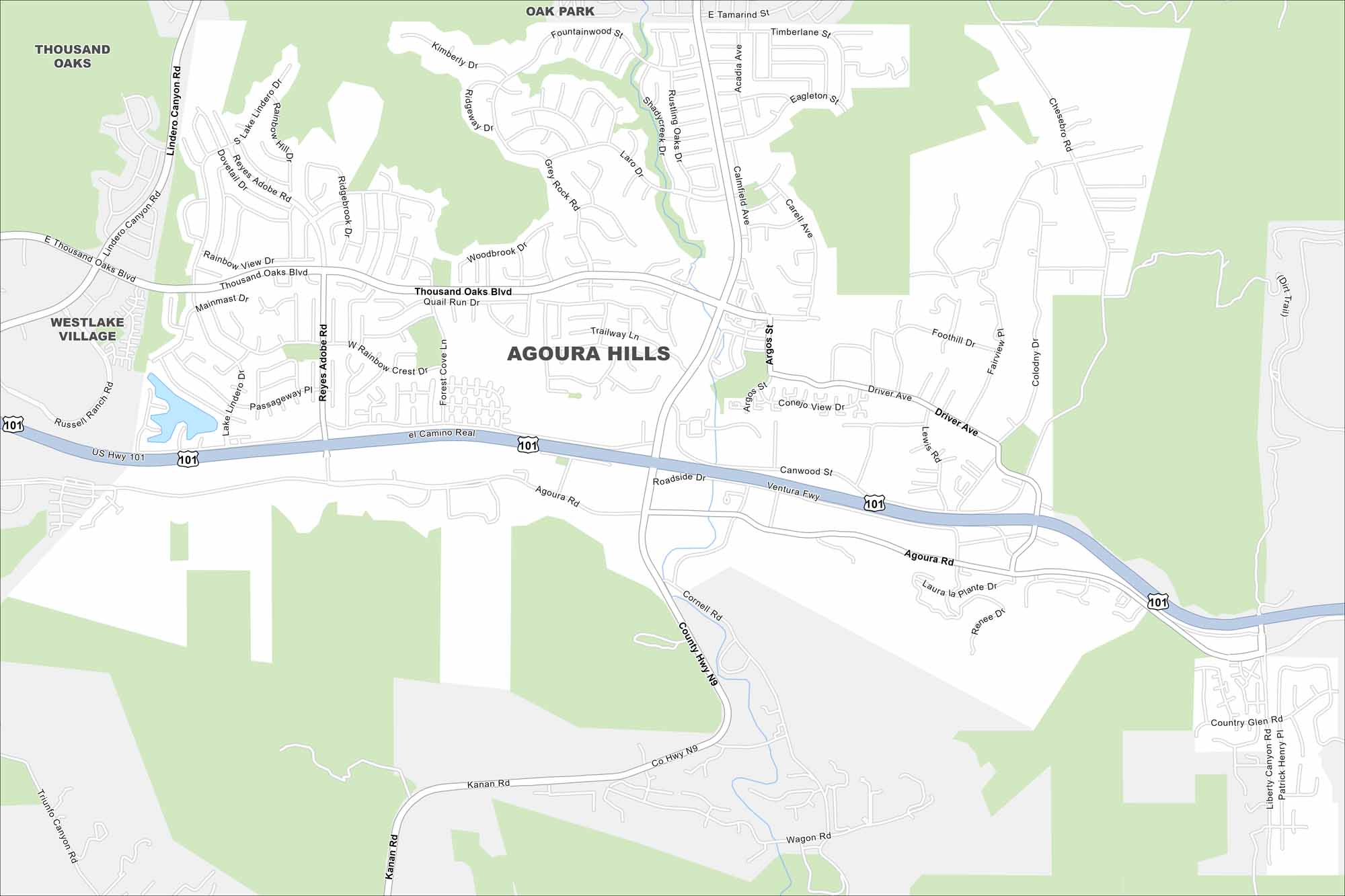
Winding canyon roads and freeway routes are main features Agoura Hills. Our map shows these types of road as well as natural features. The city is tucked against the Santa Monica Mountains, a quiet spot just beyond Los Angeles.
California State Maps
Explore California with our state maps


Map Information
On the Map
Interstates/Highways: US Hwy 101, Ventura Fwy Major Roads: Thousand Oaks Blvd, Kanan Rd, Agoura Rd, Lindero Canyon Rd, Reyes Adobe Rd, Driver Ave, Canwood St, Roadside Dr, Cornell Rd, Wagon Rd, Chesebro Rd, Colodny Dr, Argos St, Rainbow Crest Dr, Woodbrook Dr, Fountainwood St, Laro Dr, Grey Rock Rd, Ridgebrook Dr, Lake Lindero Dr Nearby Communities: Thousand Oaks, Westlake Village, Oak ParkCalifornia City Maps
Here are detailed maps of California


