Map of Aliso Viejo, California
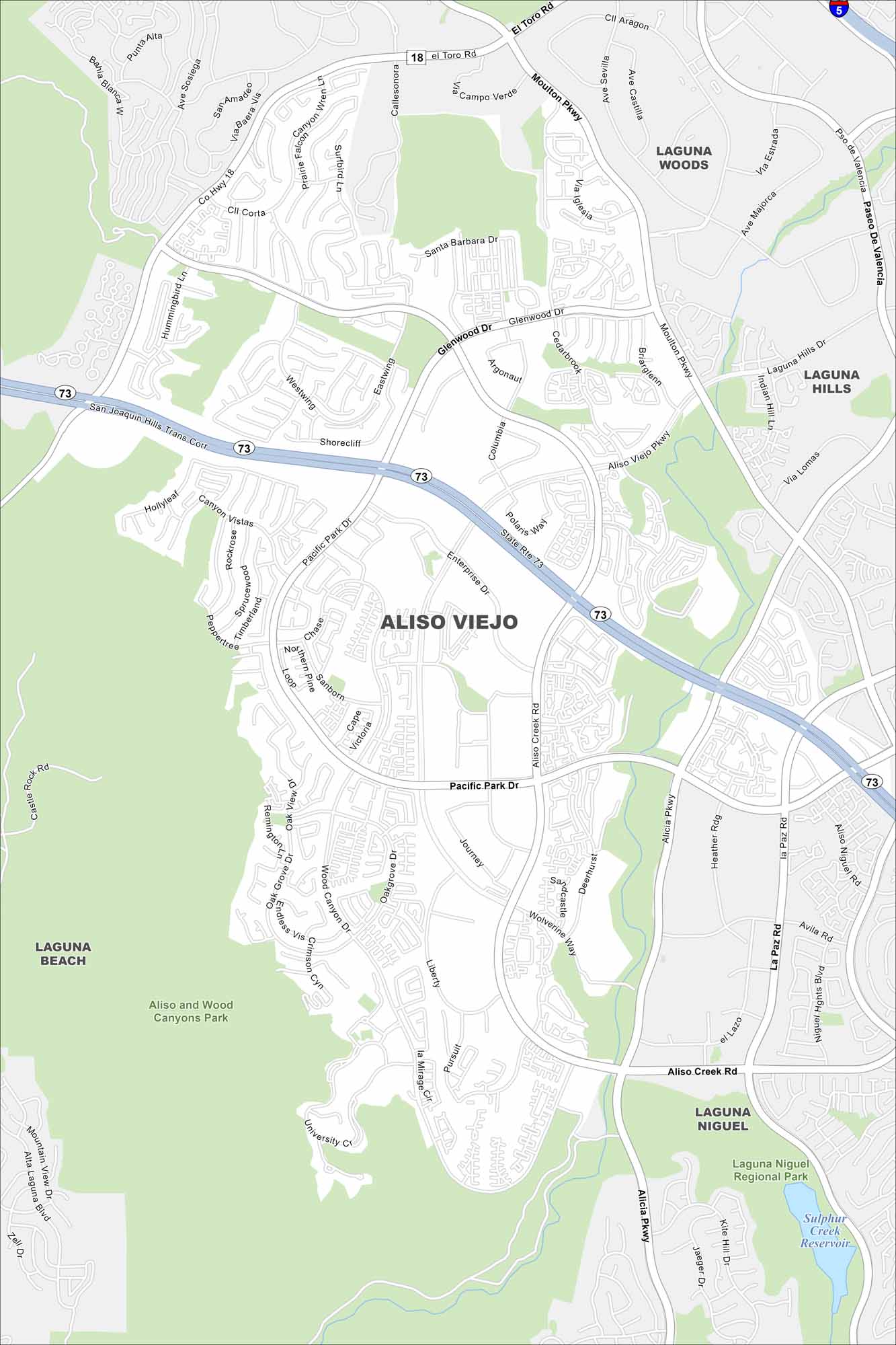
Aliso Viejo is a master-planned city in the hills of southern Orange County. Our map shows how its streets curve around canyons and parks. It gives it a more suburban, tucked-away kind of feel.
California State Maps
Explore California with our state maps


Map Information
On the Map
Interstates/Highways: State Rte 73, San Joaquin Hills Trans Corridor Major Roads: Pacific Park Dr, Aliso Creek Rd, Moulton Pkwy, Alicia Pkwy, Aliso Viejo Pkwy, El Toro Rd, Glenwood Dr, La Paz Rd, Aliso Niguel Rd, Enterprise Dr, Journey, Liberty, Wood Canyon Dr, Oakgrove Dr, Canyon Vistas, Westwing, Eastwing, Shorecliff, Argonaut, Columbia Lakes and Reservoirs: Sulphur Creek Reservoir Parks/Forests/Reserves: Aliso and Wood Canyons Park, Laguna Niguel Regional Park Nearby Communities: Laguna Woods, Laguna Hills, Laguna Niguel, Laguna BeachCalifornia City Maps
Here are detailed maps of California


