Map of Antioch, California
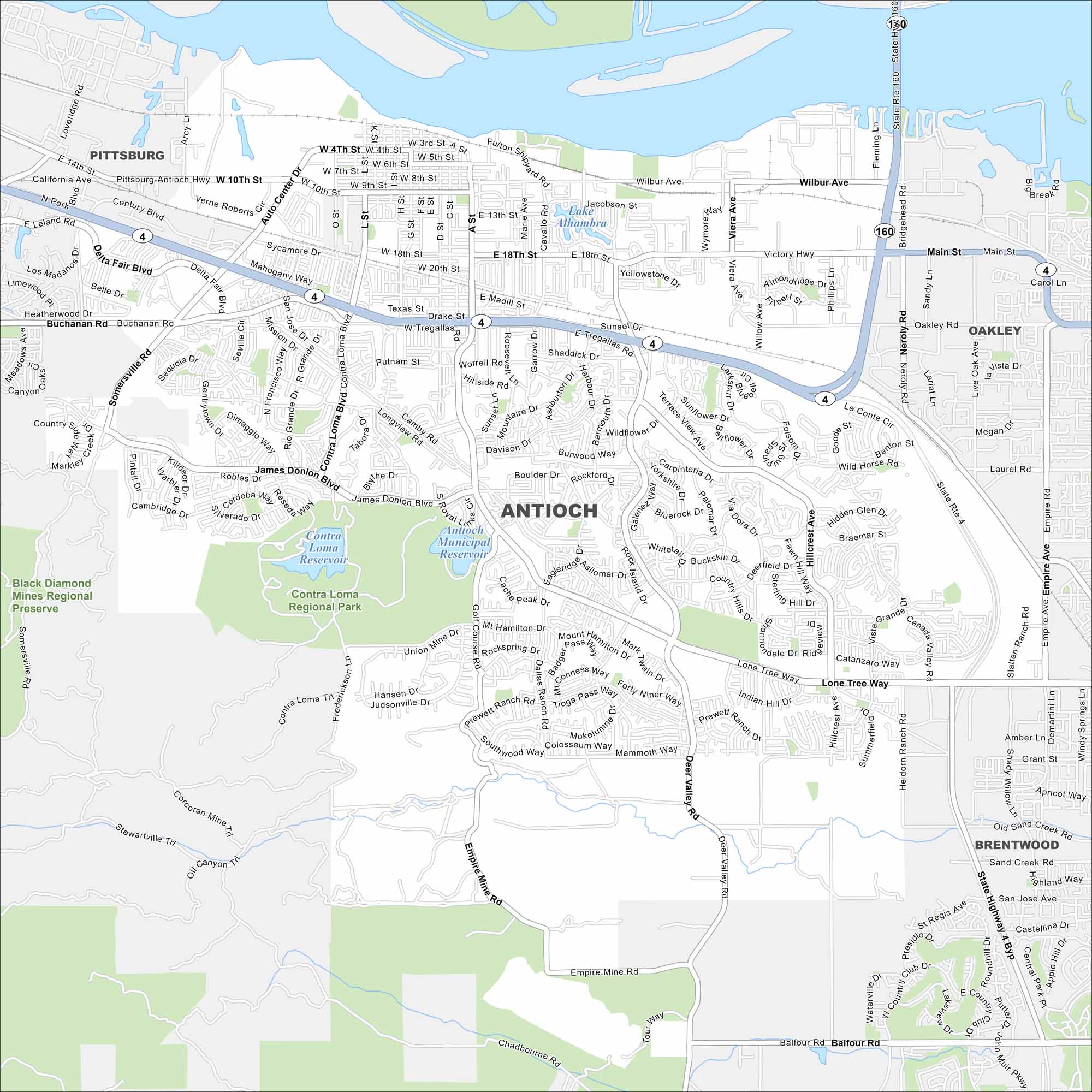
Antioch has a nice riverfront location within the San Joaquin Delta. Roads connect into the Bay Area. Antioch is one of California’s oldest towns.
California State Maps
Explore California with our state maps


Map Information
On the Map
Interstates/Highways: State Rte 4, State Rte 160 Major Roads: Lone Tree Way, James Donlon Blvd, Hillcrest Ave, Deer Valley Rd, Delta Fair Blvd, Buchanan Rd, Somersville Rd, Wilbur Ave, Main St, Contra Loma Blvd, G St, L St, A St, 10th St, 18th St, Dallas Ranch Rd, Prewett Ranch Rd, Empire Mine Rd, Balfour Rd, Neroly Rd Lakes and Reservoirs: Contra Loma Reservoir, Antioch Municipal Reservoir, Lake Alhambra Parks and Preserves: Black Diamond Mines Regional Preserve, Contra Loma Regional Park Nearby Communities: Pittsburg, Oakley, BrentwoodCalifornia City Maps
Here are detailed maps of California


