Map of Apple Valley, California
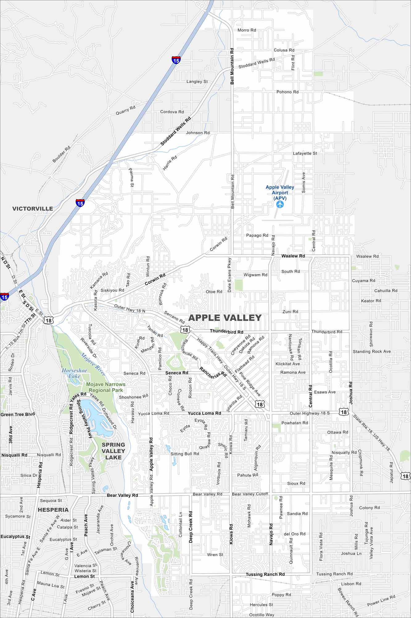
See the highways, streets, and desert routes on our map. The city is known for its wide-open Mojave Desert landscape. Our map of Apple Valley reflects its place in the Victor Valley.
California State Maps
Explore California with our state maps


Map Information
On the Map
Interstates/Highways: I-15, State Rte 18, US Hwy 18, Happy Trails Hwy, Outer Hwy 18 S Major Roads: Bear Valley Rd, Central Rd, Apple Valley Rd, Kiowa Rd, Navajo Rd, Dale Evans Pkwy, Yucca Loma Rd, Rancherias Rd, Tussing Ranch Rd, Waalew Rd, Stoddard Wells Rd, Sitting Bull Rd, Deep Creek Rd, Corwin Rd, Kasota Rd, Nisqually Rd, Ottawa Rd, Johnson Rd, Falchion Rd, Poppy Rd Airports: Apple Valley Airport (APV) Lakes and Reservoirs: Spring Valley Lake, Horseshoe Lake Major Rivers: Mojave River Parks and Preserves: Mojave Narrows Regional Park Nearby Communities: Victorville, Hesperia, Spring Valley LakeCalifornia City Maps
Here are detailed maps of California


