Map of Atascadero, California
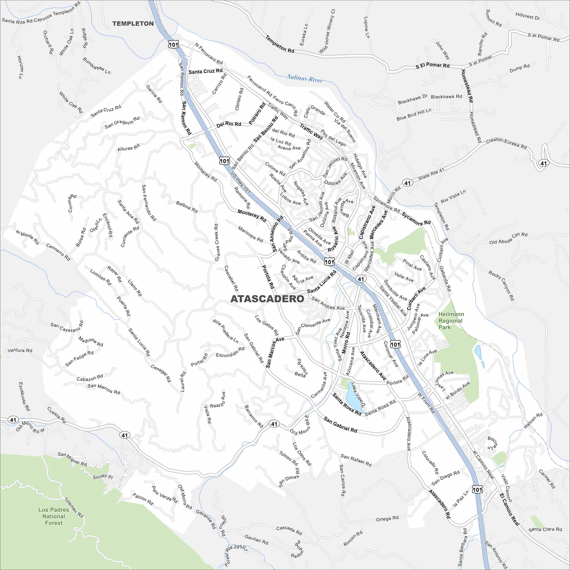
Atascadero is shown with its highways, streets, and forests. Roads cut through the rolling hills. The city is part of San Luis Obispo County.
California State Maps
Explore California with our state maps


Map Information
On the Map
Interstates/Highways: US Hwy 101, State Rte 41 Major Roads: El Camino Real, Morro Rd, Curbaril Ave, Santa Lucia Rd, San Anselmo Rd, Del Rio Rd, Santa Rosa Rd, San Gabriel Rd, Traffic Way, Monterey Rd, Portola Rd, Atascadero Ave, Halcon Rd, Capistrano Ave, Marchant Ave, San Marcos Rd, Balboa Rd, Vieja Rd, Sombrilla Ave, Santa Cruz Rd Major Rivers: Salinas River Parks and Preserves: Los Padres National Forest, Heilmann Regional Park Nearby Communities: TempletonCalifornia City Maps
Here are detailed maps of California


