Map of Austin, Texas
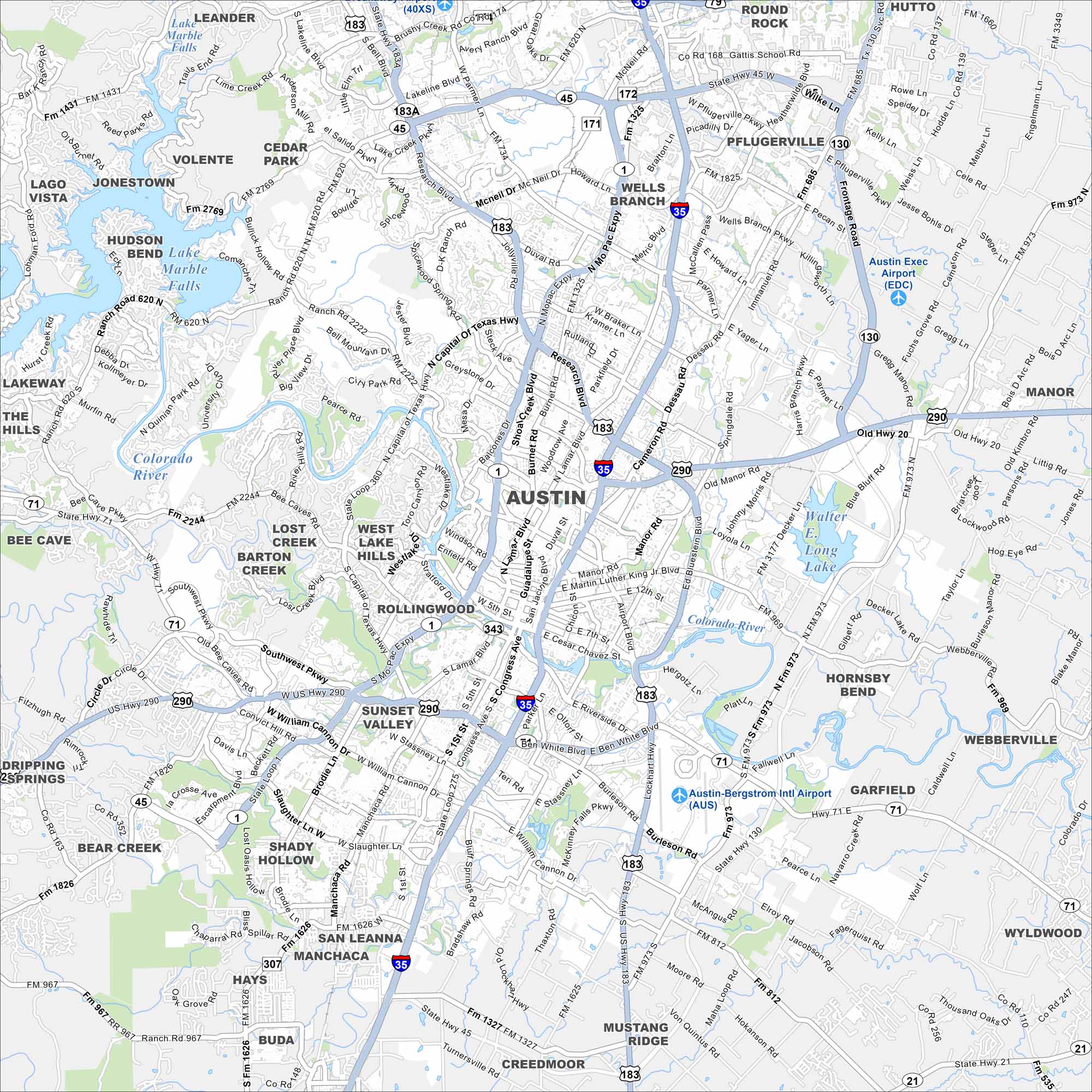
We’ve mapped out Austin with its highways, streets, and lakeside routes. You can see how the roads cut through Hill Country but still tie into downtown. The city is known as the Live Music Capital of the World.
Map Information
On the Map
Interstates/Highways: I-35, US Hwy 183, US Hwy 290, US Hwy 71, State Hwy 45, State Hwy 130, State Loop 1, State Loop 360, State Hwy 1, State Hwy 21 Major Roads: Congress Ave, Lamar Blvd, Guadalupe St, Martin Luther King Jr Blvd, Cesar Chavez St, Riverside Dr, Ben White Blvd, William Cannon Dr, Slaughter Ln, MoPac Expy, Burnet Rd, Braker Ln, Parmer Ln, Howard Ln, Wells Branch Pkwy, Dessau Rd, Manor Rd, Airport Blvd, Manchaca Rd, Brodie Ln Airports: Austin-Bergstrom Intl Airport (AUS), Austin Exec Airport (EDC) Lakes and Reservoirs: Lake Austin, Lady Bird Lake, Walter E. Long Lake, Lake Marble Falls Major Rivers: Colorado River Nearby Communities: Round Rock, Pflugerville, Hutto, Manor, Webberville, Garfield, Wyldwood, Mustang Ridge, Creedmoor, Buda, Hays, San Leanna, Shady Hollow, Bear Creek, Driftwood, Dripping Springs, Bee Cave, West Lake Hills, Rollingwood, Sunset Valley, Lost Creek, Barton Creek, Hudson Bend, Lakeway, Volente, Jonestown, Lago Vista, Cedar Park, Wells Branch, Leander Neighborhoods: Downtown AustinTexas State Maps
Scan our maps of the massive southern state of Texas.


City Maps of Texas
Explore our map collection of Texas cities.


