Map of Baldwin Park, California
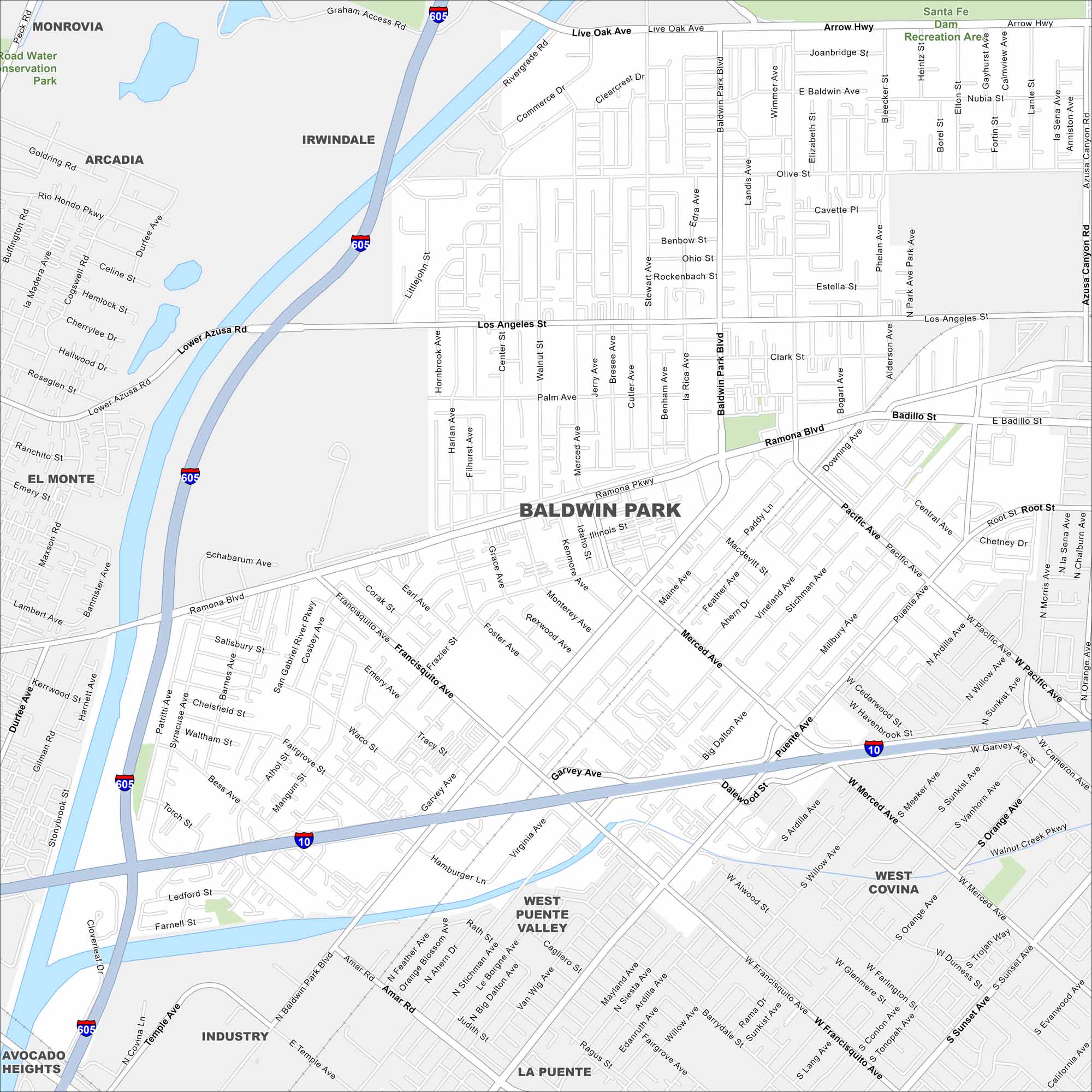
See the streets, highways, and park areas marked here. Our map of Baldwin Park reflects its spot in the San Gabriel Valley. The city is known as the birthplace of In-N-Out Burger.
California State Maps
Explore California with our state maps


Map Information
On the Map
Interstates/Highways: I-605, I-10 Major Roads: Baldwin Park Blvd, Ramona Blvd, Maine Ave, Los Angeles St, Live Oak Ave, Arrow Hwy, Puente Ave, Francisquito Ave, Lower Azusa Rd, Merced Ave, Badillo St, Pacific Ave, Garvey Ave, Amar Rd, Temple Ave, Central Ave, Olive St, Palm Ave, Frazier St, Tracy St Parks and Preserves: Santa Fe Dam Recreation Area, Road Water Conservation Park Nearby Communities: Irwindale, West Covina, West Puente Valley, El Monte, Arcadia, Monrovia, Industry, La Puente, Avocado HeightsCalifornia City Maps
Here are detailed maps of California


