Map of Barstow, California
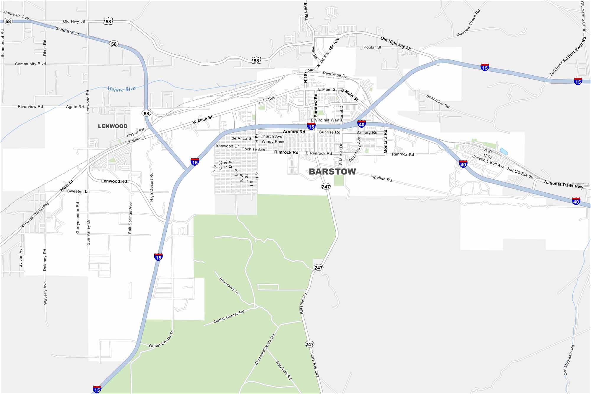
Our map of Barstow highlights the highways, rail lines, and desert layout. Roads meet here with a key Mojave Desert crossroads. Barstow is known as a major Route 66 stop.
California State Maps
Explore California with our state maps


Map Information
On the Map
Interstates/Highways: I-15, I-40, State Rte 58, Historic Route 66, Hwy 247 Major Roads: Main St, Barstow Rd, First Ave, Lenwood Rd, Muriel Dr, Montara Rd, Armory Rd, Seventh St, Rimrock Rd, Virginia Way, Flora St, Riverside Dr, Soapmine Rd, Waterman Rd, National Old Trails Hwy, Community Blvd, Poplar St, Arrowhead Ave, Markham Rd, Hinkley Rd Nearby Communities: LenwoodCalifornia City Maps
Here are detailed maps of California


