Map of Beaumont, California
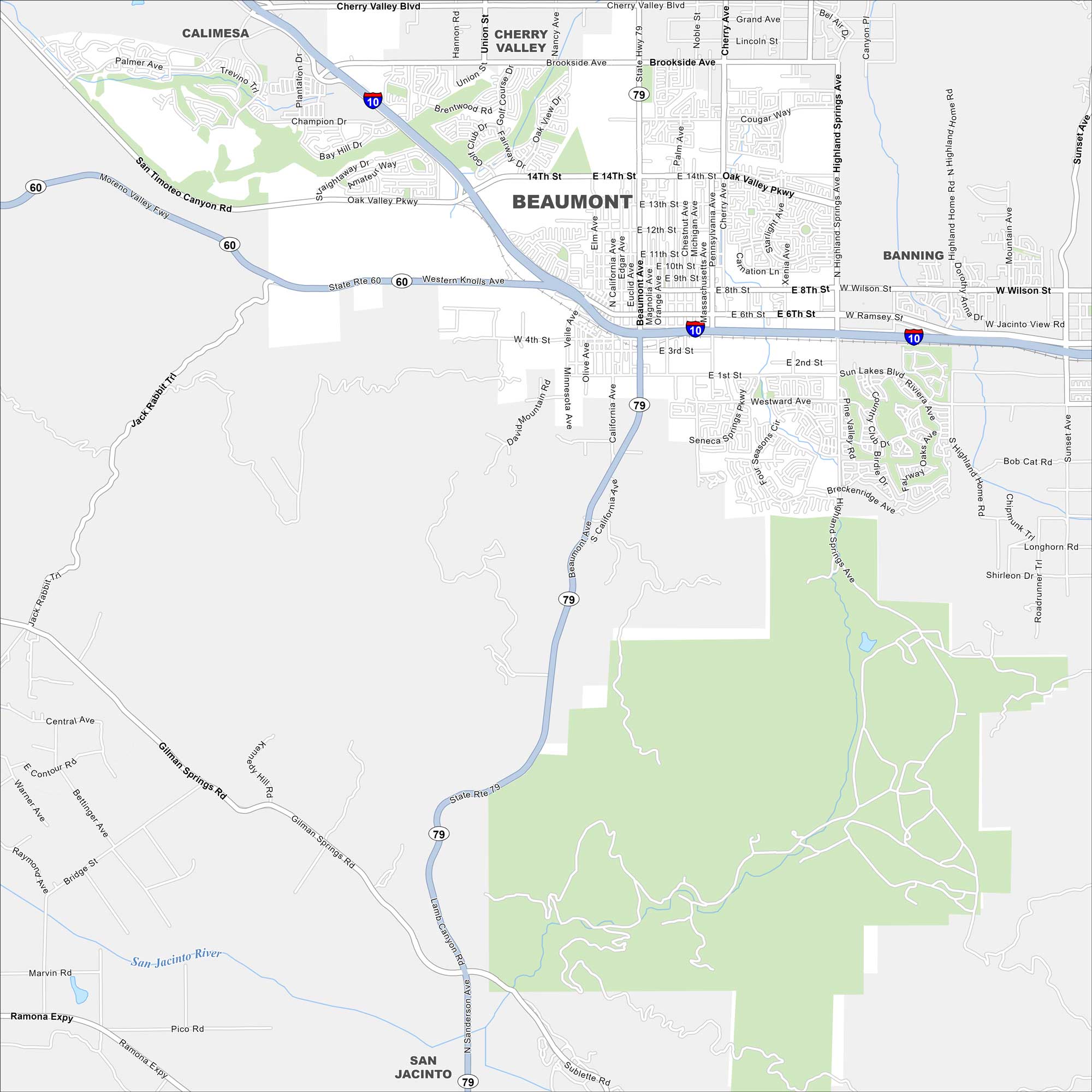
Spot what’s where in Beaumont. It’s set against the San Gorgonio Mountains. Our map shows its suburban streets and open desert spaces.
California State Maps
Explore California with our state maps


Map Information
On the Map
Interstates/Highways: I-10, State Rte 60, State Rte 79 Major Roads: Beaumont Ave, Highland Springs Ave, Oak Valley Pkwy, Cherry Valley Blvd, Brookside Ave, 6th St, 8th St, 14th St, Pennsylvania Ave, California Ave, Veile Ave, San Timoteo Canyon Rd, Gilman Springs Rd, Lamb Canyon Rd, Western Knolls Ave, Ramsey St, Wilson St, Sun Lakes Blvd, 1st St, 4th St Major Rivers: Parks and Preserves: San Jacinto River Nearby Communities: Cherry Valley, Banning, Calimesa, San JacintoCalifornia City Maps
Here are detailed maps of California


