Map of Berkeley, California
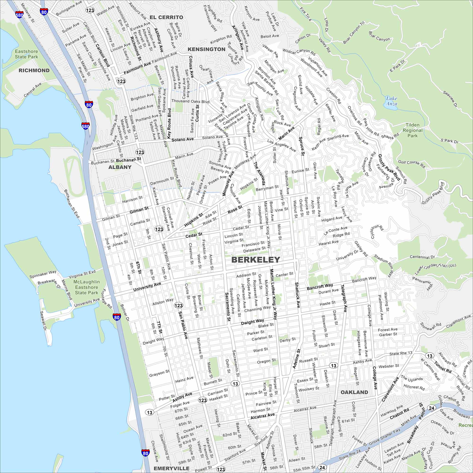
Here’s a simple map of Berkeley. Our map of Berkeley shows its streets stretching from the bay to the hills. The city is famous because of the University of California campus and its progressive culture.
California State Maps
Explore California with our state maps


Map Information
On the Map
Interstates/Highways: I-80, I-580, State Rte 123, State Rte 13, State Rte 24 Major Roads: University Ave, San Pablo Ave, Martin Luther King Jr Way, Ashby Ave, Shattuck Ave, Telegraph Ave, College Ave, Adeline St, Sacramento St, Gilman St, Solano Ave, Marin Ave, Hopkins St, Cedar St, Hearst Ave, Dwight Way, Bancroft Way, Oxford St, Claremont Ave, Tunnel Rd Lakes and Reservoirs: Lake Anza Parks and Preserves: Tilden Regional Park, McLaughlin Eastshore State Park Nearby Communities: Albany, El Cerrito, Kensington, Richmond, Emeryville, OaklandCalifornia City Maps
Here are detailed maps of California


