Map of Waukesha, Wisconsin
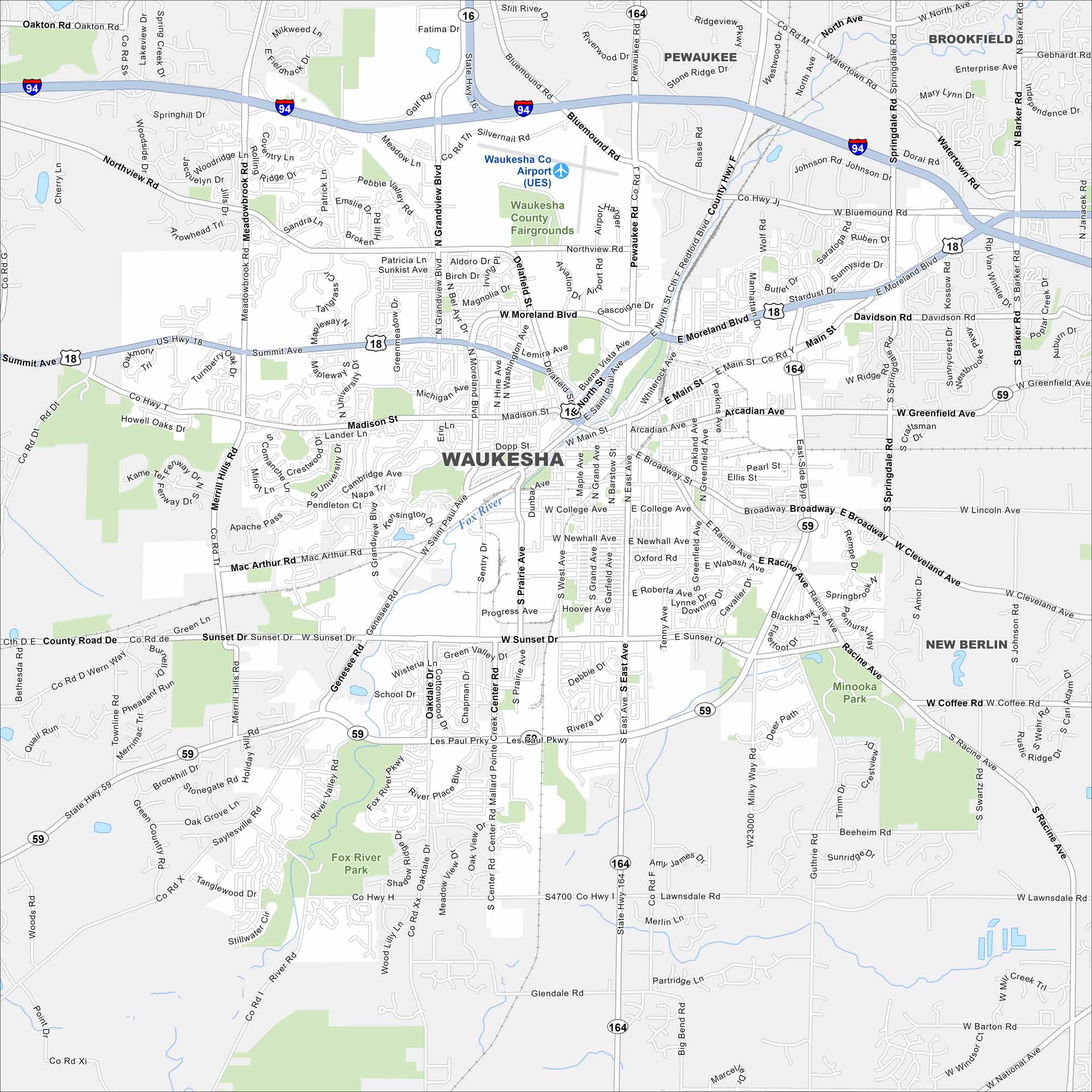
Here’s how to get around Waukesha, a city west of Milwaukee. Known for natural springs, it has a walkable downtown and plenty of parks. Use our road map to see all the major highways and streets.
Map Information
On the Map
Interstates/Highways: I-94, US Hwy 18, State Rte 59, State Rte 164, State Rte 16 Major Roads: Moreland Blvd, Main St, Madison St, Grandview Blvd, Sunset Dr, Waukesha Rd, North Ave, Bluemound Rd, Greenfield Ave, Broadway, Summit Ave, Merrill Hills Rd, Genesee Rd, St Paul Ave, Barstow St, West Ave, Grand Ave, Les Paul Pkwy, Prairie Ave, Saylesville Rd Airports: Waukesha Co Airport (UES) Major Rivers: Fox River Parks and Preserves: Waukesha County Fairgrounds, Minooka Park, Fox River Park Nearby Communities: Pewaukee, Brookfield, New BerlinWisconsin State Maps
Discover maps of the Badger State.


City Maps of Wisconsin
See our Wisconsin maps designed for clarity.


