Map of Wausau, Wisconsin
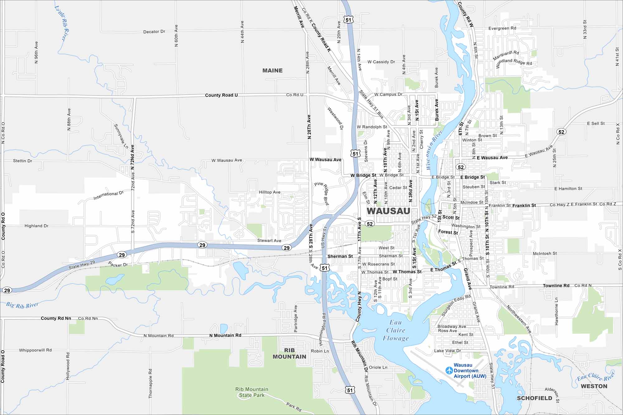
Want to see a map of Wausau, Wisconsin? Set along the Wisconsin River, it’s framed by Rib Mountain and outdoor recreation. It’s also located where WI-29 and US-51 meet.
Map Information
On the Map
Interstates/Highways: US Hwy 51, State Rte 29, State Rte 52 Major Roads: Wausau Ave, Bridge St, Stewart Ave, Thomas St, Grand Ave, 6th St, 17th Ave, 1st Ave, 3rd St, 10th St, Scott St, Townline Rd, 72nd Ave, 28th Ave, Merrill Ave, Campus Dr, Westwood Dr, Sherman St, Bopf St, River Rd Airports: Wausau Downtown Airport (AUW) Lakes and Reservoirs: Eau Claire Flowage Major Rivers: Wisconsin River, Big Rib River, Little Rib River Parks and Preserves: Rib Mountain State Park Nearby Communities: Maine, Rib Mountain, Schofield, WestonWisconsin State Maps
Discover maps of the Badger State.


City Maps of Wisconsin
See our Wisconsin maps designed for clarity.


