Map of Brentwood, Tennessee
Explore Brentwood with our map. It’s known for large homes and green spaces. The city is close to Nashville but holds its own calm character.
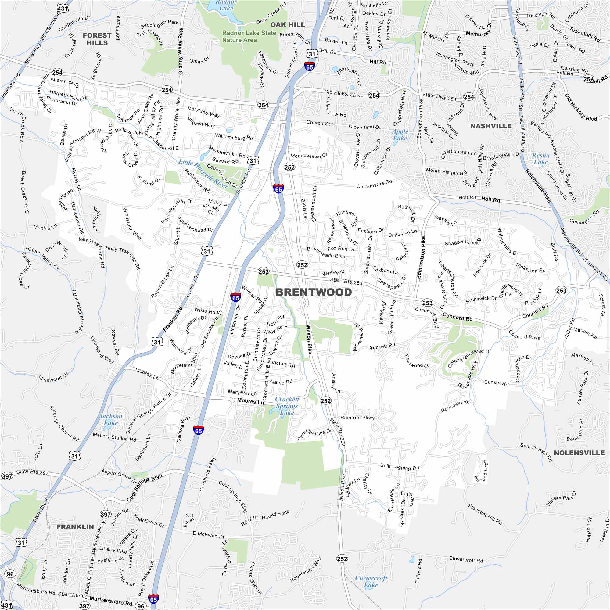
Map Information
On the Map
Interstates/Highways: I-65, US Hwy 31, US Hwy 411, US Hwy 41, State Rte 254, State Rte 252, State Rte 253, State Rte 397, State Rte 96 Major Roads: Old Hickory Blvd, Franklin Rd, Concord Rd, Wilson Pike, Cool Springs Blvd, Granny White Pike, Murray Ln, Moores Ln, Carothers Pkwy, Mallory Ln, Edmonson Pike, Nolensville Pike, Sunset Rd, McEwen Dr, General George Patton Dr, Church St, Ward Dr, Split Log Rd, Crockett Rd, Clovercroft Rd Lakes and Reservoirs: Radnor Lake, Apple Lake, Crockett Springs Lake, Jackson Lake, Clovercroft Lake Major Rivers: Little Harpeth River Parks and Preserves: Radnor Lake State Nature Area Nearby Communities: Nashville, Franklin, Nolensville, Forest Hills, Oak HillTennessee State Maps
Here are our state maps of Tennessee.


City Maps of Tennessee
Explore our Tennessee map collection


