Map of Bristol, Connecticut
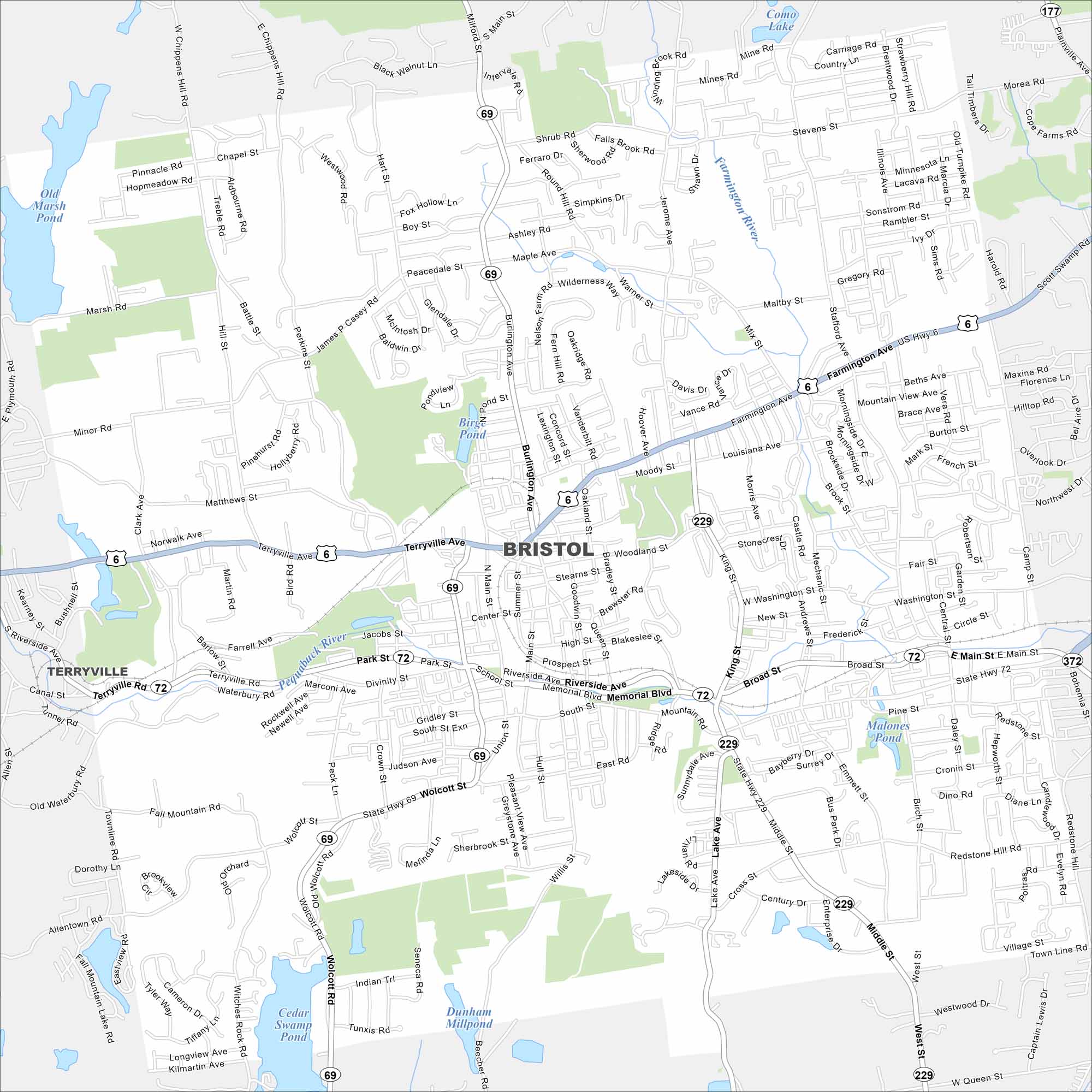
See Bristol with our road map. This area is home to quiet neighborhoods and corporate offices. Parks cut through the city but industry still plays a role.
Connecticut State Maps
Here’s your getaway to Connecticut geography


Map Information
On the Map
Interstates/Highways: US Hwy 6, State Rte 72, State Rte 69, State Rte 229, State Rte 372 Major Roads: Farmington Ave, Terryville Ave, Riverside Ave, Memorial Blvd, Main St, Middle St, Wolcott Rd, Pine St, Stafford Ave, King St, Burlington Ave, Louisiana Ave, Mountain Rd, South St, West St, Jerome Ave, Stevens St, Matthews St, Peacedale St, Shrub Rd Airports: Lakes and Reservoirs: Birge Pond, Malones Pond, Cedar Swamp Pond, Dunham Millpond, Old Marsh Pond, Como Lake, Hoppers Pond Major Rivers: Pequabuck River Nearby Communities: Terryville, Wolcott, PlainvilleConnecticut City Maps
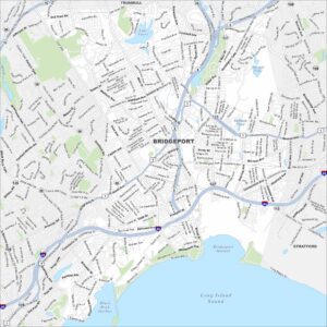
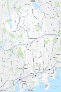
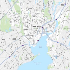
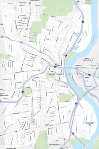
Browse Hartford and Connecticut’s city centers