Map of Calabasas, California
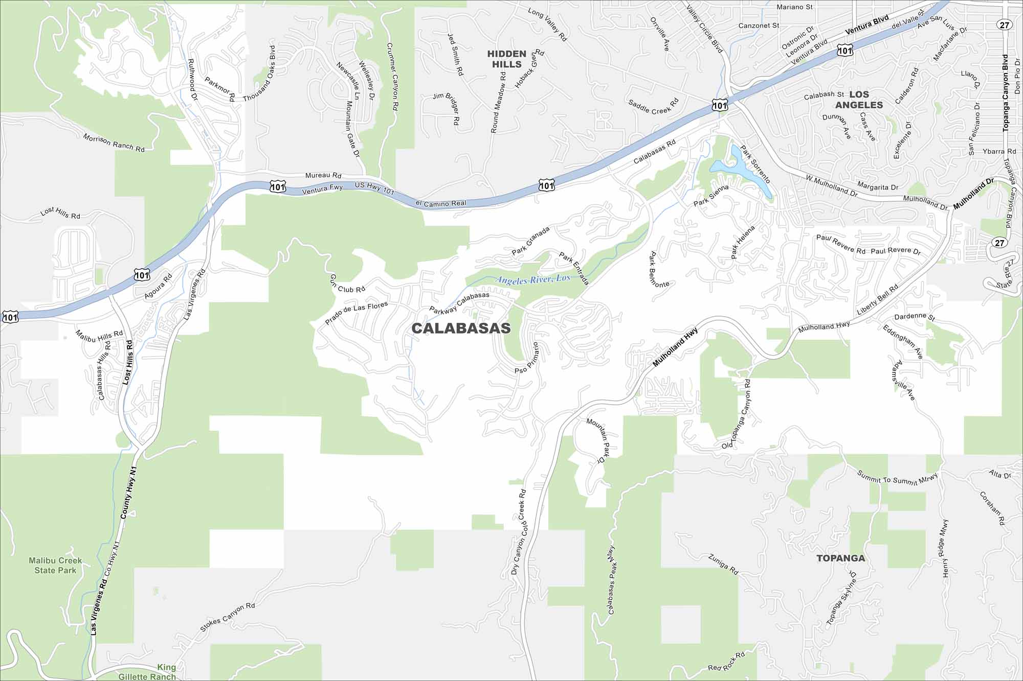
Explore Calabasas with our map, where neighborhoods wind through the Santa Monica Mountains. Roads curve instead of form grids because of the hills. The terrain gives it a peaceful and secluded feel.
California State Maps
Explore California with our state maps


Map Information
On the Map
Interstates/Highways: U.S. Hwy 101 Major Roads: Ventura Fwy, Mulholland Hwy, Mulholland Dr, Las Virgenes Rd, Calabasas Rd, Parkway Calabasas, Agoura Rd, Topanga Canyon Blvd, Malibu Hills Rd, Lost Hills Rd, Mureau Rd, Valderas Dr, Dry Canyon Cold Creek Rd, Old Topanga Canyon Rd, Summit To Summit Mtwy, Henry Ridge Mtwy, Calabasas Peak Mtwy, Paul Revere Rd, Dumetz Rd, Park Sorrento Major Rivers: Los Angeles River Parks and Preserves: Malibu Creek State Park Nearby Communities: Hidden Hills, Topanga, Los AngelesCalifornia City Maps
Here are detailed maps of California


