Map of Carpinteria, California
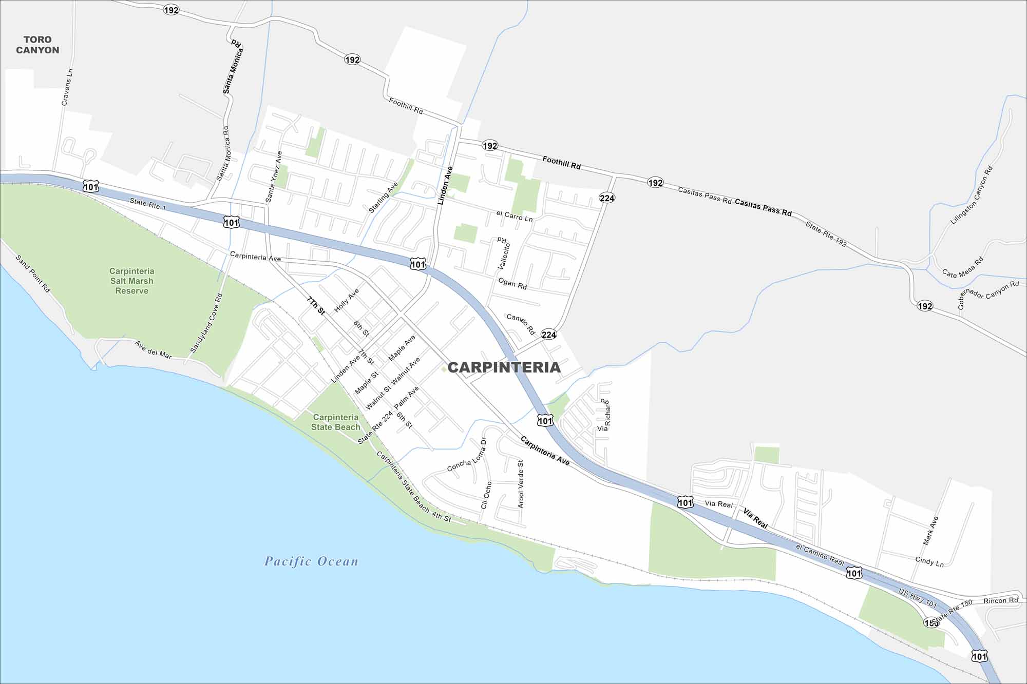
Explore Carpinteria on our map, set along the California coast. This city is small but surrounded by ocean views and foothills. It’s often called “the world’s safest beach” because of its gentle surf.
California State Maps
Explore California with our state maps


Map Information
On the Map
Interstates/Highways: U.S. Hwy 101, State Rte 1, State Rte 150, State Rte 192, State Rte 224 Major Roads: Carpinteria Ave, Foothill Rd, Casitas Pass Rd, Linden Ave, Via Real, El Camino Real, Santa Monica Rd, Sterling Ave, Sandpoint Rd, Sandyland Cove Rd, 7th St, 8th St, Maple Ave, Palm Ave, 6th St, 4th St, Rincon Rd, Cate Mesa Rd, Gobernador Canyon Rd, Lilingston Canyon Rd Lakes and Reservoirs: Pacific Ocean Parks and Preserves: Carpinteria Salt Marsh Reserve, Carpinteria State Beach Nearby Communities: Toro CanyonCalifornia City Maps
Here are detailed maps of California


