Map of Ceres, California
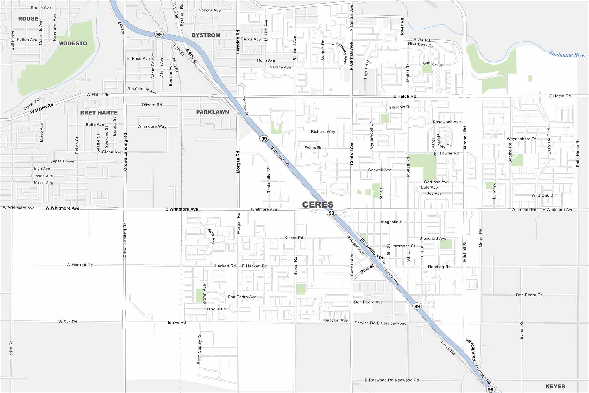
See Ceres on our map with its neighborhoods and farmland. It’s located in California’s Central Valley near Modesto. Agriculture plays a big role here because of the fertile valley soils.
California State Maps
Explore California with our state maps


Map Information
On the Map
Interstates/Highways: State Hwy 99 Major Roads: Hatch Rd, Whitmore Ave, Mitchell Rd, Central Ave, Crows Landing Rd, Morgan Rd, Blaker Rd, Richland Ave, Moffett Rd, Service Rd, Redwood Rd, Kinser Rd, Hackett Rd, Roeding Rd, Magnolia St, Pine St, El Camino Ave, Railroad Ave, Fowler Rd, Boothe Rd Major Rivers: Tuolumne River Parks and Preserves: Modesto, Rouse, Bystrom, Parklawn, Bret Harte, KeyesCalifornia City Maps
Here are detailed maps of California


