Map of Cerritos, California
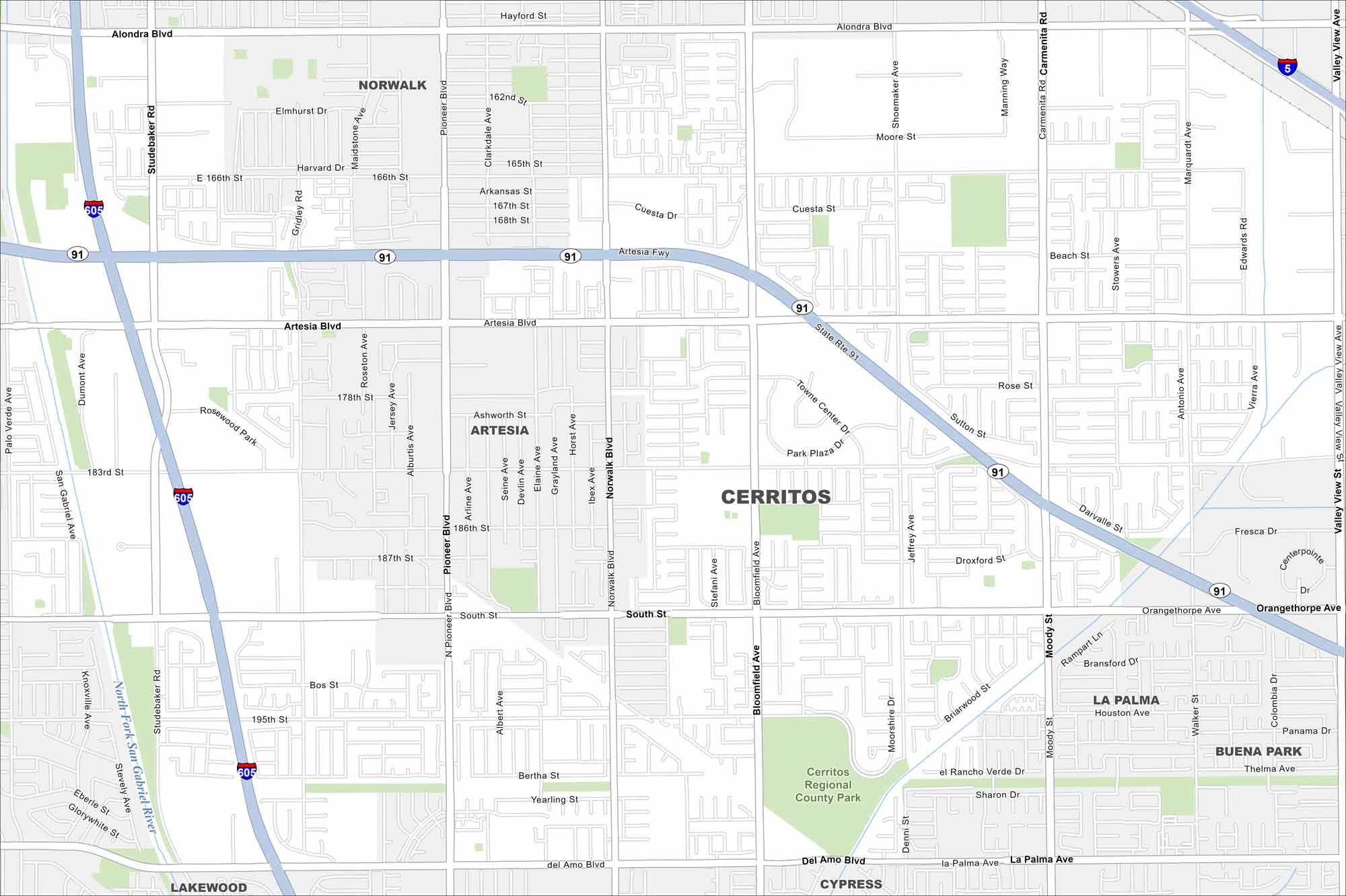
Our map of Cerritos highlights planned neighborhoods and open parks. The city sits in southeast Los Angeles County with easy regional connections. It’s suburban in feel, but still firmly tied to the LA metro.
California State Maps
Explore California with our state maps


Map Information
On the Map
Interstates/Highways: I-5, I-605, State Rte 91 Major Roads: Artesia Blvd, South St, Alondra Blvd, Del Amo Blvd, Bloomfield Ave, Norwalk Blvd, Studebaker Ave, Gridley Rd, Pioneer Blvd, Carmenita Rd, Shoemaker Ave, Marquardt Ave, Valley View Ave, Moody St, Walker St, Palo Verde Ave, San Gabriel Ave, 183rd St, 166th St, 195th St Major Rivers: North Fork San Gabriel River Parks and Preserves: Cerritos Regional County Park Nearby Communities: Norwalk, Artesia, La Palma, Buena Park, Cypress, LakewoodCalifornia City Maps
Here are detailed maps of California


