Map of West Allis, Wisconsin
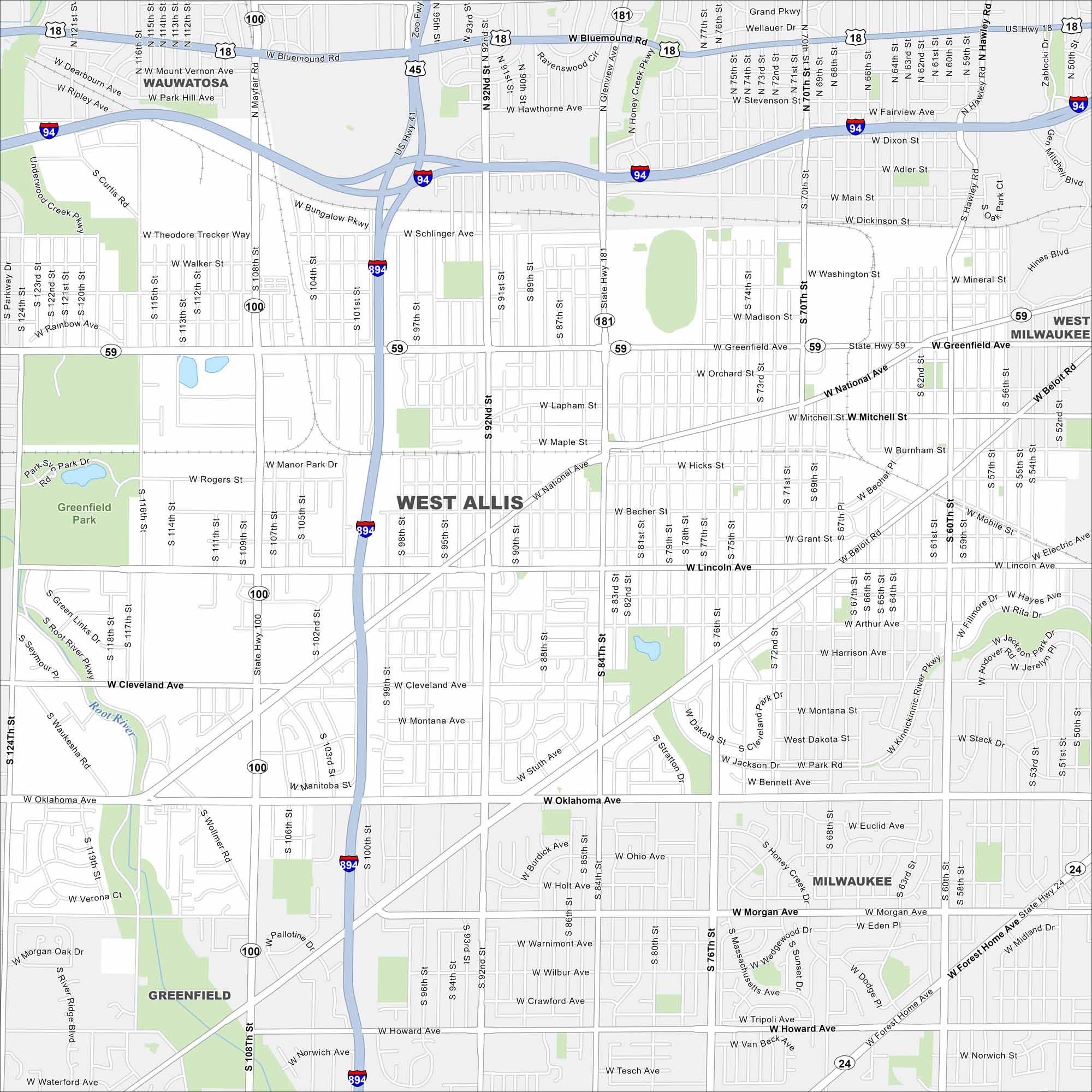
Our map of West Allis highlights this Milwaukee suburb’s busy streets. Once tied to industry, today it’s known for its fairs, shops, and neighborhoods.
Map Information
On the Map
Interstates/Highways: I-94, I-894, State Rte 100, State Rte 59, State Rte 181, State Rte 24 Major Roads: Greenfield Ave, National Ave, Lincoln Ave, Oklahoma Ave, 108th St, 84th St, 92nd St, 76th St, 60th St, Cleveland Ave, Beloit Rd, Becher St, Morgan Ave, Howard Ave, Mitchell St, Lapham St, Burnham St, Schlinger Ave, Theo Trecker Way, West Allis Pkwy Major Rivers: Root River Parks and Preserves: Greenfield Park Nearby Communities: Milwaukee, West Milwaukee, Greenfield, WauwatosaWisconsin State Maps
Discover maps of the Badger State.


City Maps of Wisconsin
See our Wisconsin maps designed for clarity.


