Map of Chino Hills, California
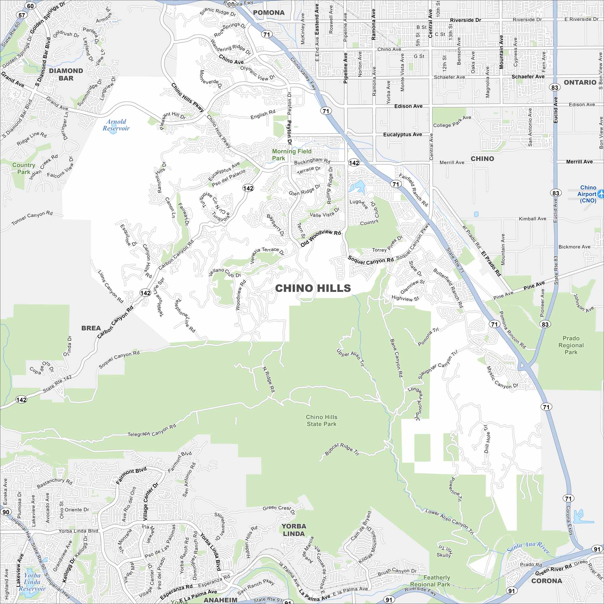
See our map of Chino Hills with its streets, highways, and parkland. This city is set among rolling hills on the edge of the Inland Empire.
California State Maps
Explore California with our state maps


Map Information
On the Map
Interstates/Highways: State Rte 71, State Rte 142, State Rte 91, State Rte 83, State Rte 90, State Rte 60 Major Roads: Chino Hills Pkwy, Carbon Canyon Rd, Grand Ave, Eucalyptus Ave, Soquel Canyon Rd, Peyton Dr, Pipeline Ave, Valle Vista Dr, Glen Ridge Dr, Woodview Rd, Butterfield Ranch Rd, Pine Ave, Shady View Dr, Village Center Dr, Yorba Linda Blvd, Fairmont Blvd, Bastanchury Rd, Rincon Rd, Pomona Trl, Slaughter Canyon Rd Lakes and Reservoirs: Arnold Reservoir, Yorba Linda Reservoir Major Rivers: Santa Ana River Parks and Preserves: Chino Hills State Park, Prado Regional Park, Morning Field Park, Country Club Indian Views Park Nearby Communities: Chino, Pomona, Diamond Bar, Brea, Yorba Linda, Anaheim, CoronaCalifornia City Maps
Here are detailed maps of California


