Map of Chippewa Falls, Wisconsin
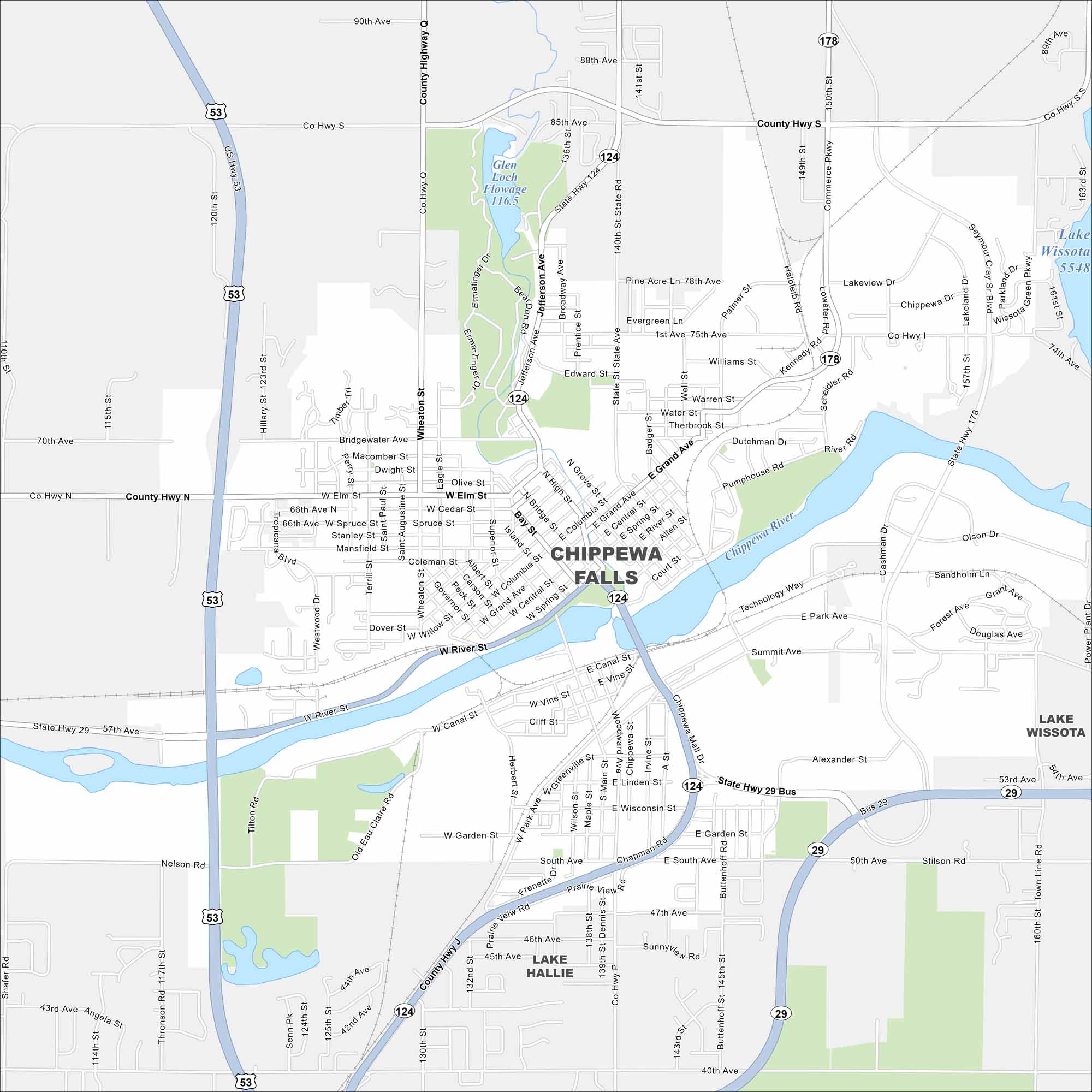
Chippewa Falls lies on the Chippewa River, with bridges tying together its neighborhoods. Lakes and forests spread north of the city. This really gives the map a distinctly northern Wisconsin feel.
Map Information
On the Map
Interstates/Highways: US Hwy 53, State Rte 29, State Rte 124, State Rte 178 Major Roads: Bridge St, Main St, Grand Ave, River St, Park Ave, Woodward Ave, Canal St, Garden St, Wisconsin St, 1st Ave, 40th Ave, 50th Ave, 120th St, Hallie Rd, Commerce Pkwy, Kennedy Rd, Lakeview Dr, Olson Dr, Alexander St, Seymour Cray Blvd Lakes and Reservoirs: Lake Wissota, Glen Loch Flowage Major Rivers: Chippewa River Nearby Communities: Lake HallieWisconsin State Maps
Discover maps of the Badger State.


City Maps of Wisconsin
See our Wisconsin maps designed for clarity.


