Map of Clarksville, Tennessee
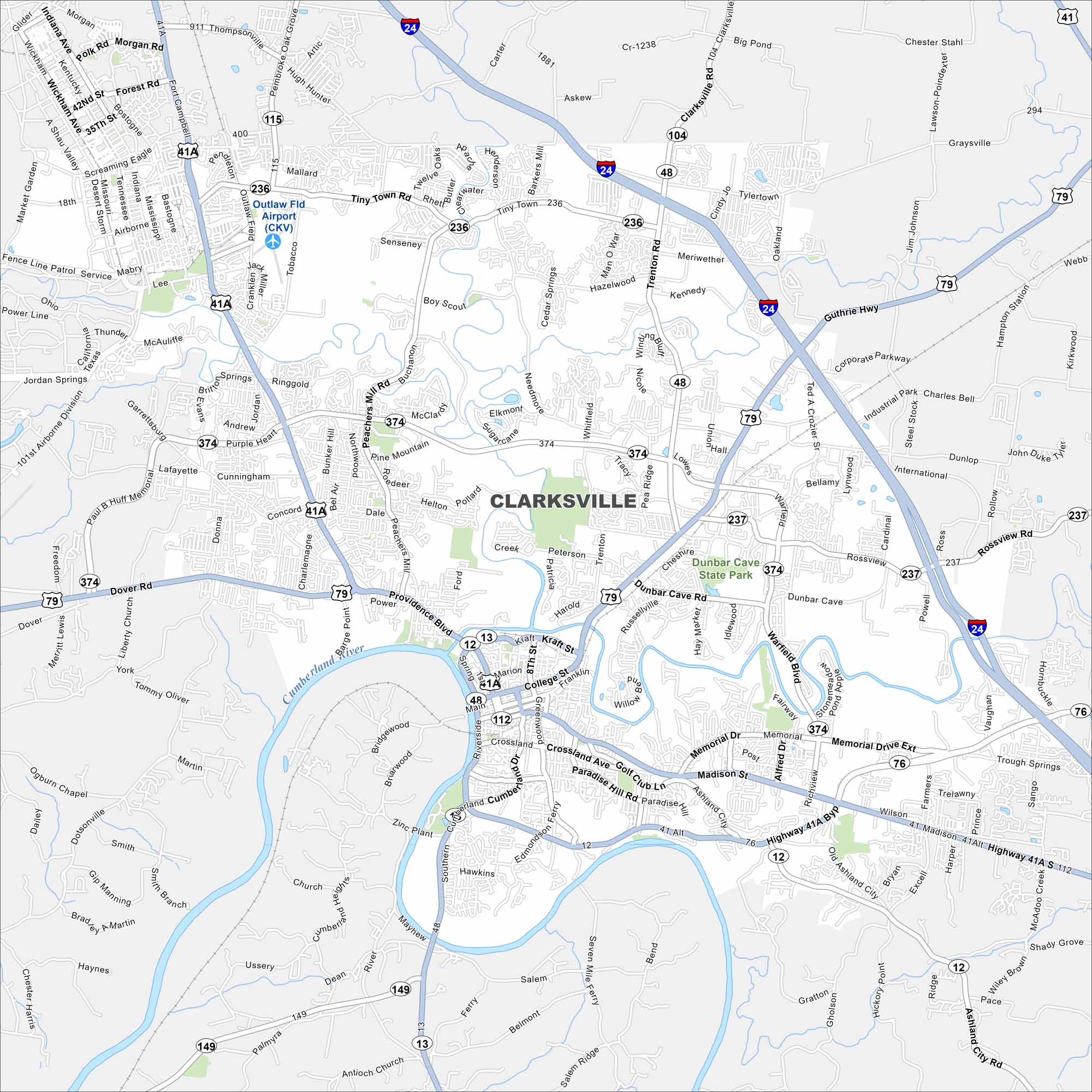
Our map of Clarksville highlights the Cumberland River as it bends through downtown. It’s home to Austin Peay State University and Fort Campbell nearby.
Map Information
On the Map
Interstates/Highways: I-24, US Hwy 41A, US Hwy 79, State Rte 48, State Rte 13, State Rte 12, State Rte 374, State Rte 236, State Rte 237, State Rte 115, State Rte 149, State Rte 112, State Rte 76 Major Roads: Wilma Rudolph Blvd, Ft Campbell Blvd, Madison St, Tiny Town Rd, Memorial Dr, Warfield Blvd, Trenton Rd, 101st Airborne Div Pkwy, Peachers Mill Rd, Dover Rd, Providence Blvd, Riverside Dr, Kraft St, College St, Crossland Ave, Ashland City Rd, Whitfield Rd, Dunlop Ln, Rossview Rd, Old Ashland City Rd Airports: Outlaw Fld Airport (CKV) Major Rivers: Cumberland River, Red River Parks and Preserves: Dunbar Cave State Park Nearby Communities: Oak Grove, Sango, WoodlawnTennessee State Maps
Here are our state maps of Tennessee.


City Maps of Tennessee
Explore our Tennessee map collection


