Map of Concord, California
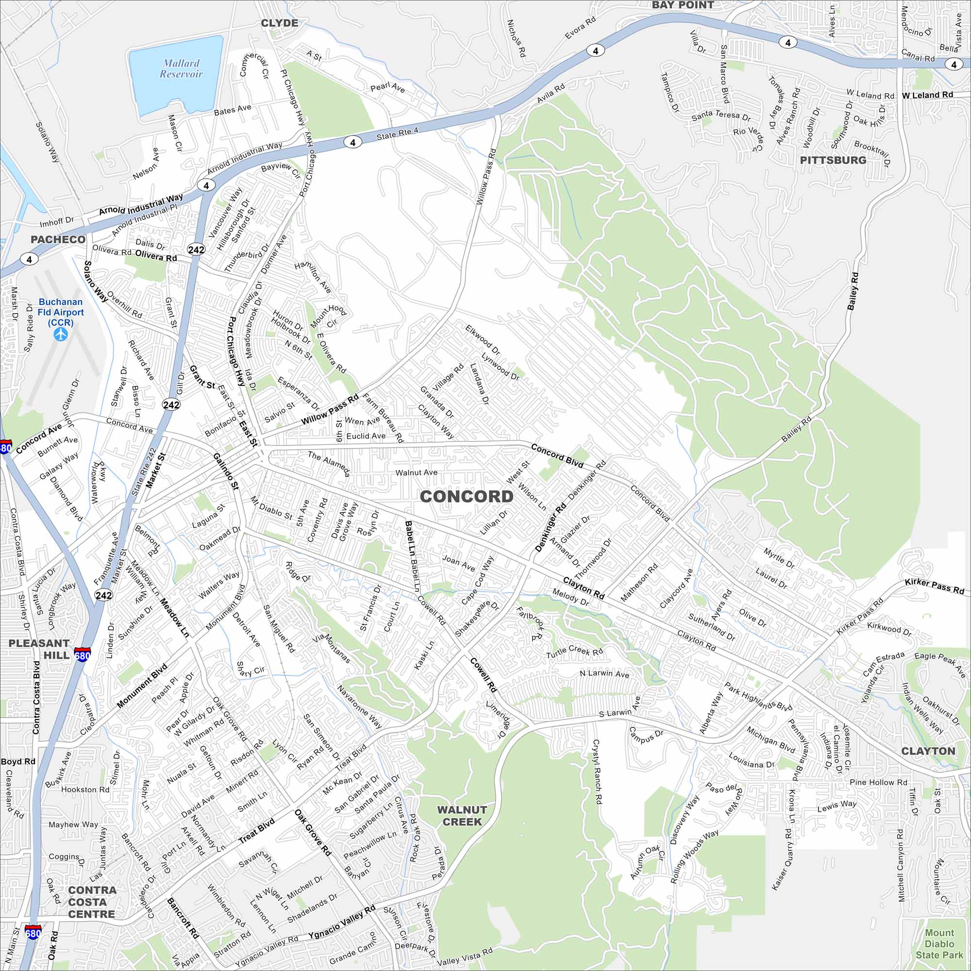
We’ve mapped out Concord with its mapped waterways, highways, and parks. The city sits in the East Bay region, near Mount Diablo. Parks and open spaces spread around the edges.
California State Maps
Explore California with our state maps


Map Information
On the Map
Interstates/Highways: State Rte 242, I-680, State Rte 4 Major Roads: Concord Blvd, Clayton Rd, Willow Pass Rd, Monument Blvd, Treat Blvd, Galindo St, Port Chicago Hwy, Kirker Pass Rd, Ygnacio Valley Rd, Cowell Rd, San Miguel Rd, Oak Grove Rd, Meadow Ln, Market St, Salvio St, Bonifacio St, Ellis St, Detroit Ave, Pine Hollow Rd, Bailey Rd Airports: Buchanan Fld Airport (CCR) Lakes and Reservoirs: Mallard Reservoir Parks and Preserves: Mount Diablo State Park Nearby Communities: Pacheco, Pleasant Hill, Walnut Creek, Clayton, Pittsburg, Bay Point, ClydeCalifornia City Maps
Here are detailed maps of California


