Map of Dana Point, California
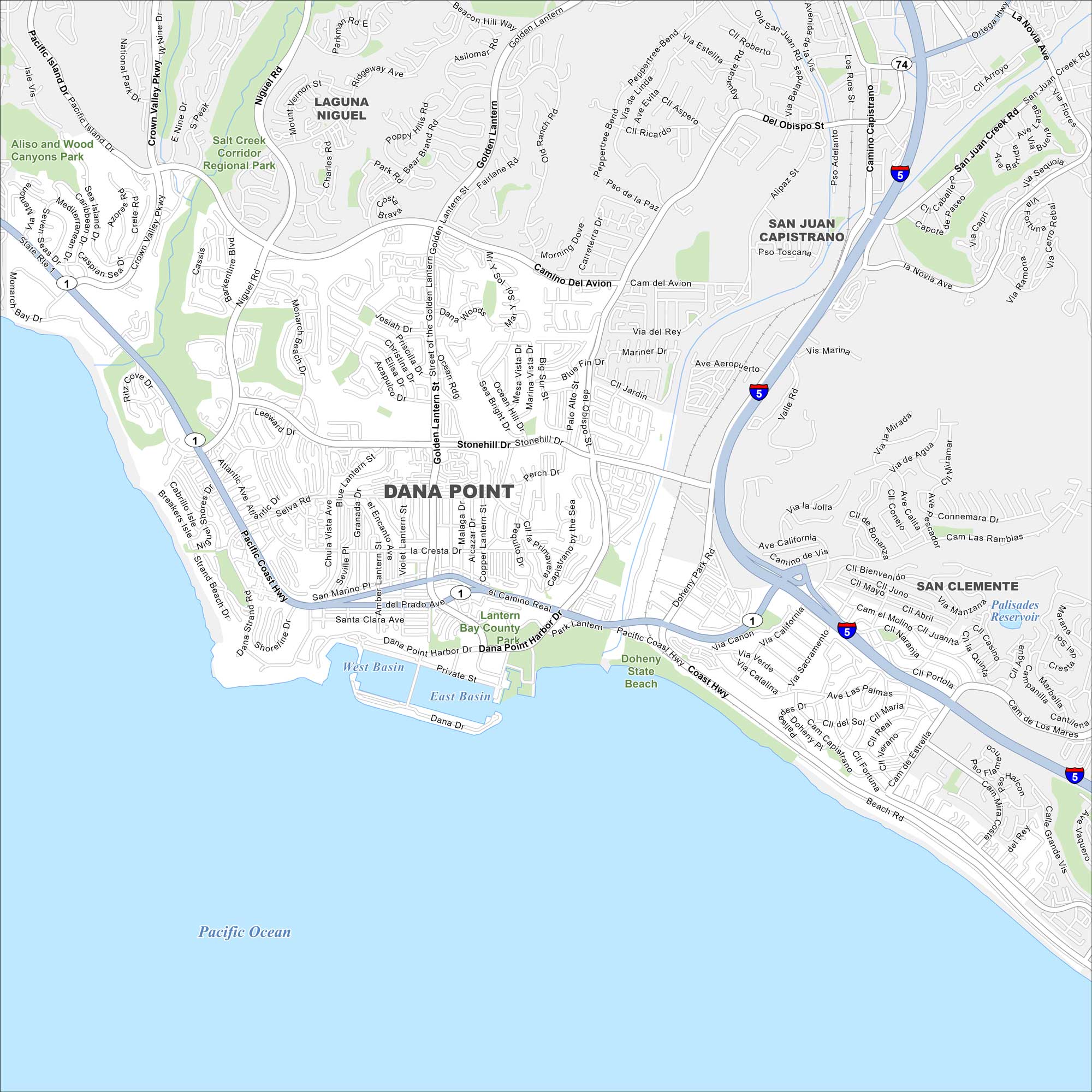
Our map of Dana Point shows its streets, highways, and shoreline. The city is perched on the Pacific Ocean between Los Angeles and San Diego. Its marina and beaches make it a popular stop.
California State Maps
Explore California with our state maps


Map Information
On the Map
Interstates/Highways: I-5, Pacific Coast Hwy, Ortega Hwy Major Roads: San Juan Creek Rd, Del Obispo St, Golden Lantern St, Stonehill Dr, Camino Del Avion, Doheny Park Rd, Blue Lantern St, Street of the Golden Lantern, Niguel Rd, Crown Valley Pkwy, Selva Rd, Ritz Carlton Dr, Beach Rd, Valle Rd, Via La Jolla, Camino de Estrella, Camino Capistrano Lakes and Reservoirs: West Basin, East Basin, Pacific Ocean, Palisades Reservoir Parks and Preserves: Salt Creek Corridor Regional Park, Aliso and Wood Canyons Park, Lantern Bay County Park, Doheny State Beach Nearby Communities: Laguna Niguel, San Juan Capistrano, San ClementeCalifornia City Maps
Here are detailed maps of California


