Map of Dublin, California
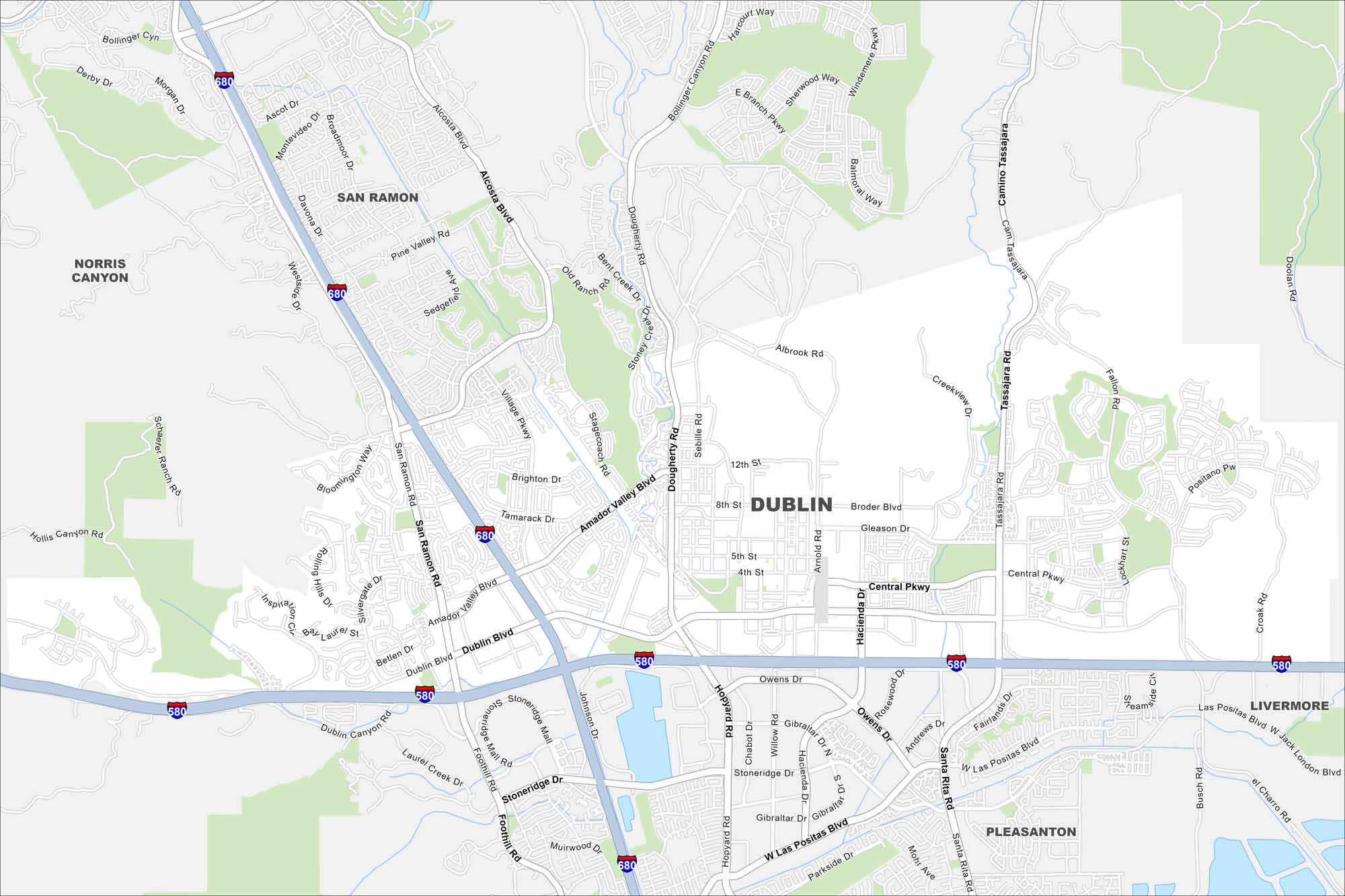
Explore Dublin on our map, situated in the East Bay region. Major highways meet here, surrounded by hills and new neighborhoods. Its crossroads position makes it one of the fastest-growing cities in the area.
California State Maps
Explore California with our state maps


Map Information
On the Map
Interstates/Highways: I-580, I-680 Major Roads: Dublin Blvd, San Ramon Rd, Tassajara Rd, Dougherty Rd, Village Pkwy, Amador Valley Blvd, Hacienda Dr, Central Pkwy, Johnson Dr, Foothill Rd, Stoneridge Dr, Alcosta Blvd, Arnold Rd, Gleason Dr, Broder Blvd, Silvergate Dr, Fallon Rd, Croak Rd, Jack London Blvd, Las Positas Blvd Nearby Communities: San Ramon, Pleasanton, Livermore, Norris CanyonCalifornia City Maps
Here are detailed maps of California


