Map of El Monte, California
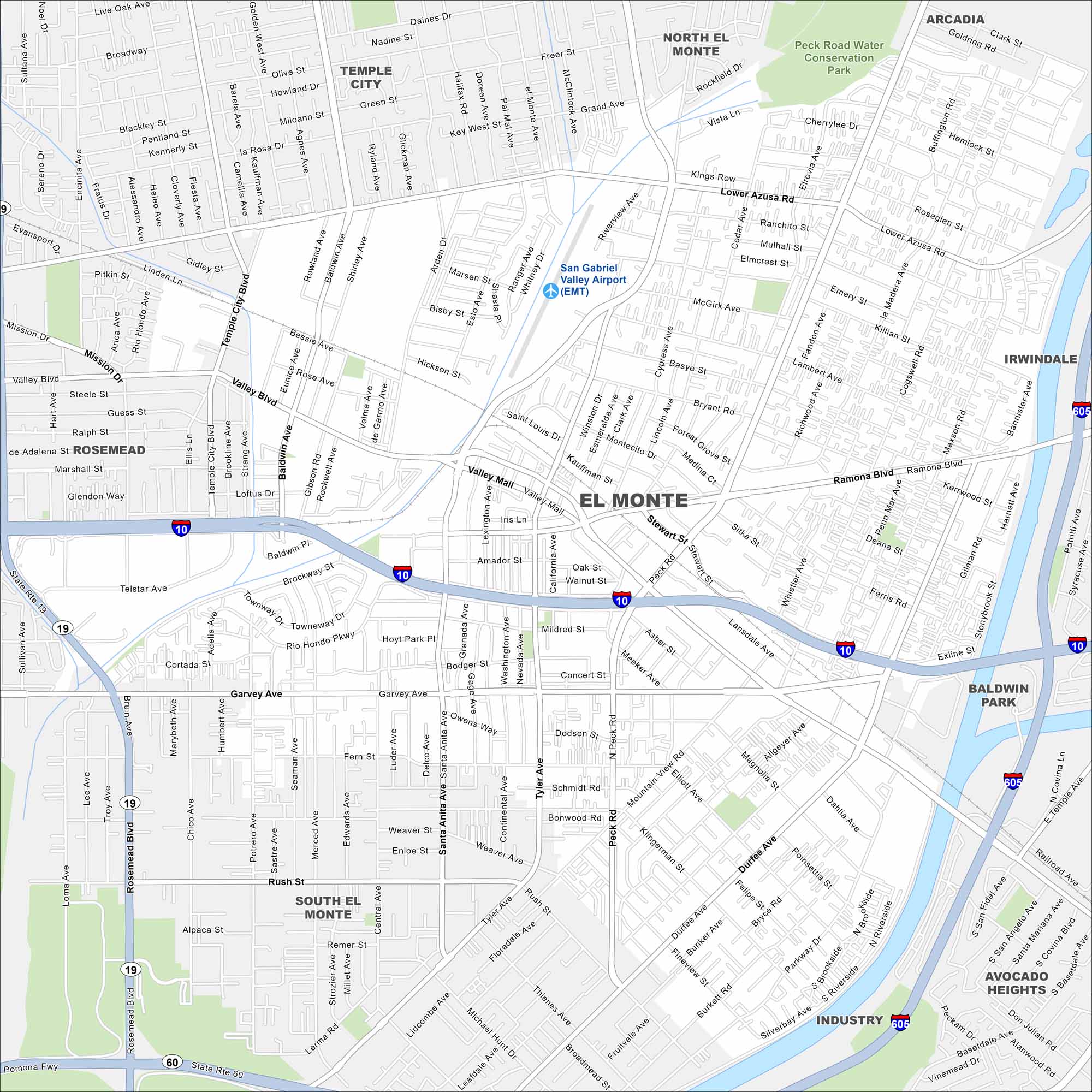
Explore El Monte in the San Gabriel Valley. The San Gabriel River runs along the edge of the city. It was once known as the “End of the Santa Fe Trail”, marking a stop for westward settlers.
California State Maps
Explore California with our state maps


Map Information
On the Map
Interstates/Highways: I-10, I-605, State Rte 19, State Rte 60 Major Roads: Valley Blvd, Garvey Ave, Peck Rd, Ramona Blvd, Lower Azusa Rd, Tyler Ave, Santa Anita Ave, Rosemead Blvd, Baldwin Ave, Durfee Ave, Rush St, Mountain View Rd, Temple City Blvd, Live Oak Ave, Broadway, Central Ave, Cogswell Rd, Elliott Ave, Parkway Dr, Thienes Ave Airports: San Gabriel Valley Airport (EMT) Major Rivers: San Gabriel River Parks and Preserves: Peck Road Water Conservation Park Nearby Communities: Temple City, Arcadia, Irwindale, Baldwin Park, Industry, Avocado Heights, South El Monte, RosemeadCalifornia City Maps
Here are detailed maps of California


