Map of Elizabeth, New Jersey
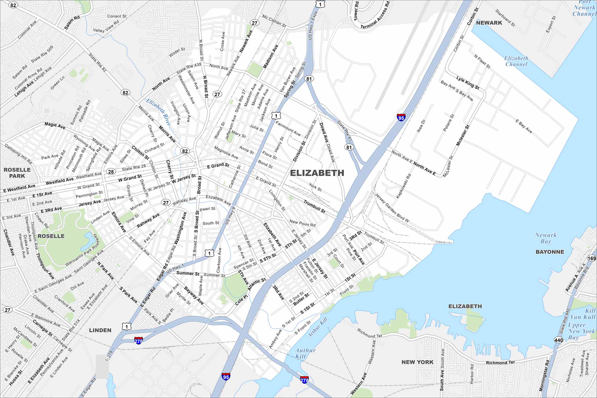
Elizabeth sits on Newark Bay with busy port terminals along the shoreline. Dense city blocks stretch westward toward highways linking into New York City. It stands out as one of New Jersey’s most historic industrial hubs.
Map Information
On the Map
Interstates/Highways: I-95, I-278, US Hwy 1, US Hwy 9, State Rte 27, State Rte 28, State Rte 81, State Rte 82, State Rte 439, State Rte 440, State Rte 509, State Rte 514 Major Roads: Newark Ave, North Ave, Elizabeth Ave, Jersey Ave, Rahway Ave, Broad St, Spring St, Dowd Ave, Division St, Jefferson Ave, Madison Ave, Westminster Ave, Morris Ave, Magie Ave, Westfield Ave, Elmora Ave, Bayway Ave, Edgar Rd, Trumbull St, Kapkowski Rd Lakes and Reservoirs: Newark Bay, Kill Van Kull, Upper New York Bay Major Rivers: Elizabeth River, Arthur Kill Nearby Communities: Newark, Bayonne, New York, Linden, Roselle, Roselle ParkNew Jersey State Maps
Explore maps from the Garden State.


City Maps of New Jersey
Newark and New Jersey cities in complete detail


