Map of Fond du Lac, Wisconsin
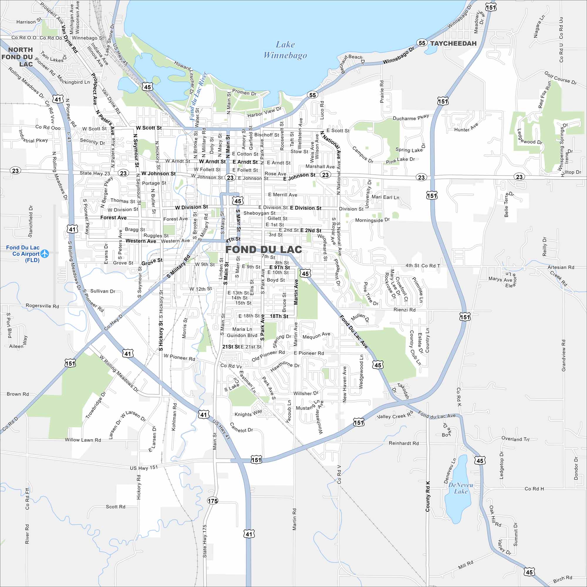
Fond du Lac is at the southern tip of Lake Winnebago. Streets spread out from the shoreline into farmland. The lakefront location is key here.
Map Information
On the Map
Interstates/Highways: I-41, US Hwy 45, US Hwy 151, State Rte 23, State Rte 175, State Rte 55 Major Roads: Main St, Johnson St, Scott St, Pioneer Rd, Military Rd, Rolling Meadows Dr, National Ave, University Dr, Martin Ave, Park Ave, 4th St, 14th St, 21st St, Division St, Forest Ave, Western Ave, Winnebago Dr, DuCharme Pkwy, Rienzi Rd, Hickory St Airports: Fond Du Lac Co Airport Lakes and Reservoirs: Lake Winnebago, DeNeveu Lake Major Rivers: Fond du Lac River Nearby Communities: North Fond du Lac, TaycheedahWisconsin State Maps
Discover maps of the Badger State.


City Maps of Wisconsin
See our Wisconsin maps designed for clarity.


