Map of Fort Worth, Texas
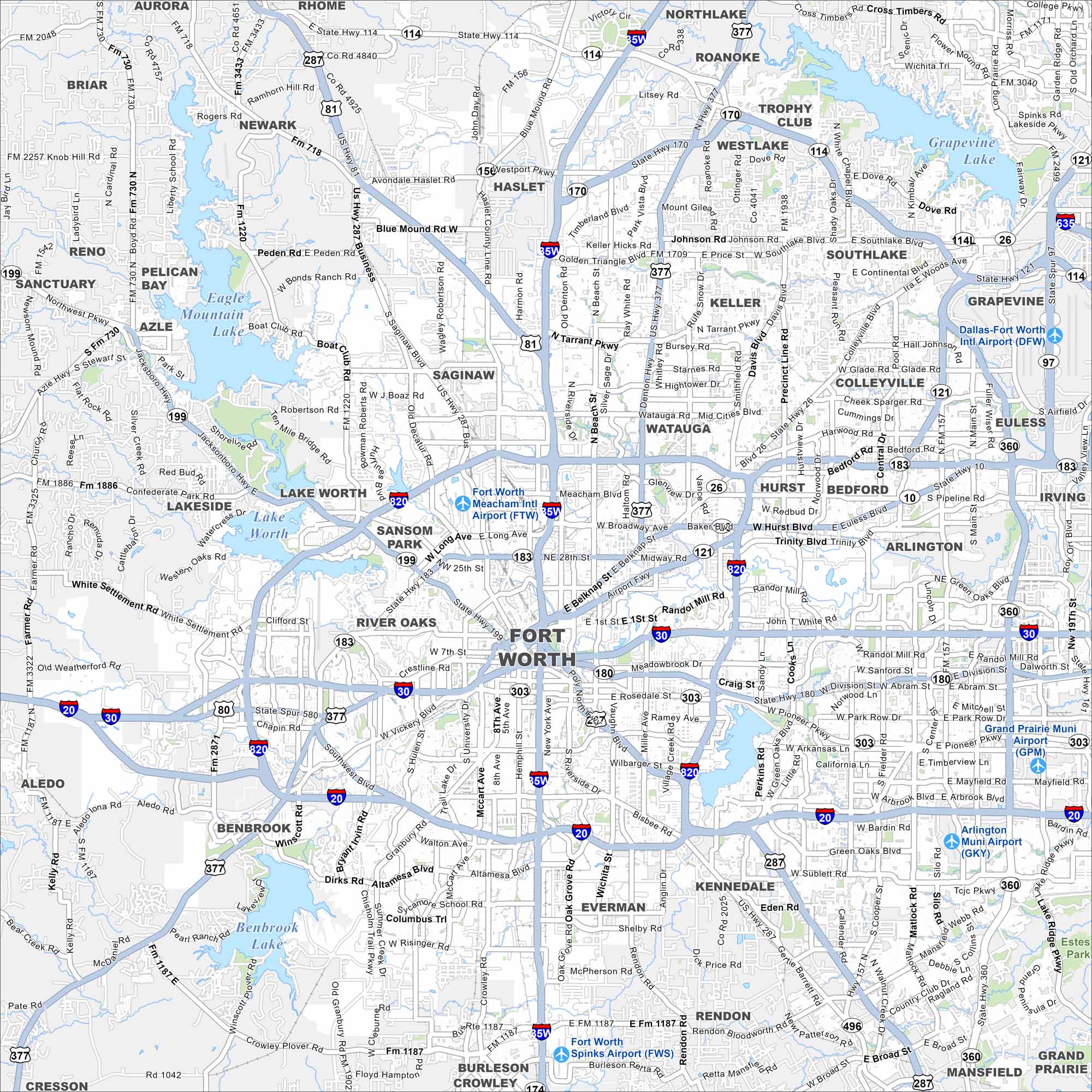
Explore our map of Fort Worth to see I-35W, I-30, and I-20 linking the city across North Texas. The Trinity River winds around downtown with neighborhoods spreading outward. Fort Worth is often called “Where the West Begins” because of its deep cowboy heritage.
Map Information
On the Map
Interstates/Highways: I-35W, I-20, I-30, I-820, US Hwy 287, US Hwy 81, US Hwy 377, State Rte 114, State Rte 121, State Rte 170, State Rte 183, State Rte 199, State Rte 360, State Rte 180 Major Roads: Belknap St, Main St, University Dr, McCart Ave, Hulen St, Vickery Blvd, Altamesa Blvd, Crowley Rd, Mansfield Hwy, Collins St, Cooper St, Matlock Rd, Heritage Trace Pkwy, Basswood Blvd, Western Center Blvd, Meacham Blvd, Jacksboro Hwy, White Settlement Rd, Camp Bowie Blvd, Lancaster Ave Airports: Dallas-Fort Worth Intl Airport (DFW), Fort Worth Meacham Intl Airport (FTW), Fort Worth Spinks Airport (FWS), Grand Prairie Muni Airport (GPM), Arlington Muni Airport (GKY) Lakes and Reservoirs: Lake Worth, Eagle Mountain Lake, Benbrook Lake, Grapevine Lake Nearby Communities: Arlington, Grand Prairie, Mansfield, Kennedale, Everman, Benbrook, River Oaks, Sansom Park, Lake Worth, Lakeside, Saginaw, Blue Mound, Haslet, Keller, Watauga, Hurst, Bedford, Euless, Grapevine Neighborhoods: Downtown Fort WorthTexas State Maps
Scan our maps of the massive southern state of Texas.


City Maps of Texas
Explore our map collection of Texas cities.


