Map of Franklin, Tennessee
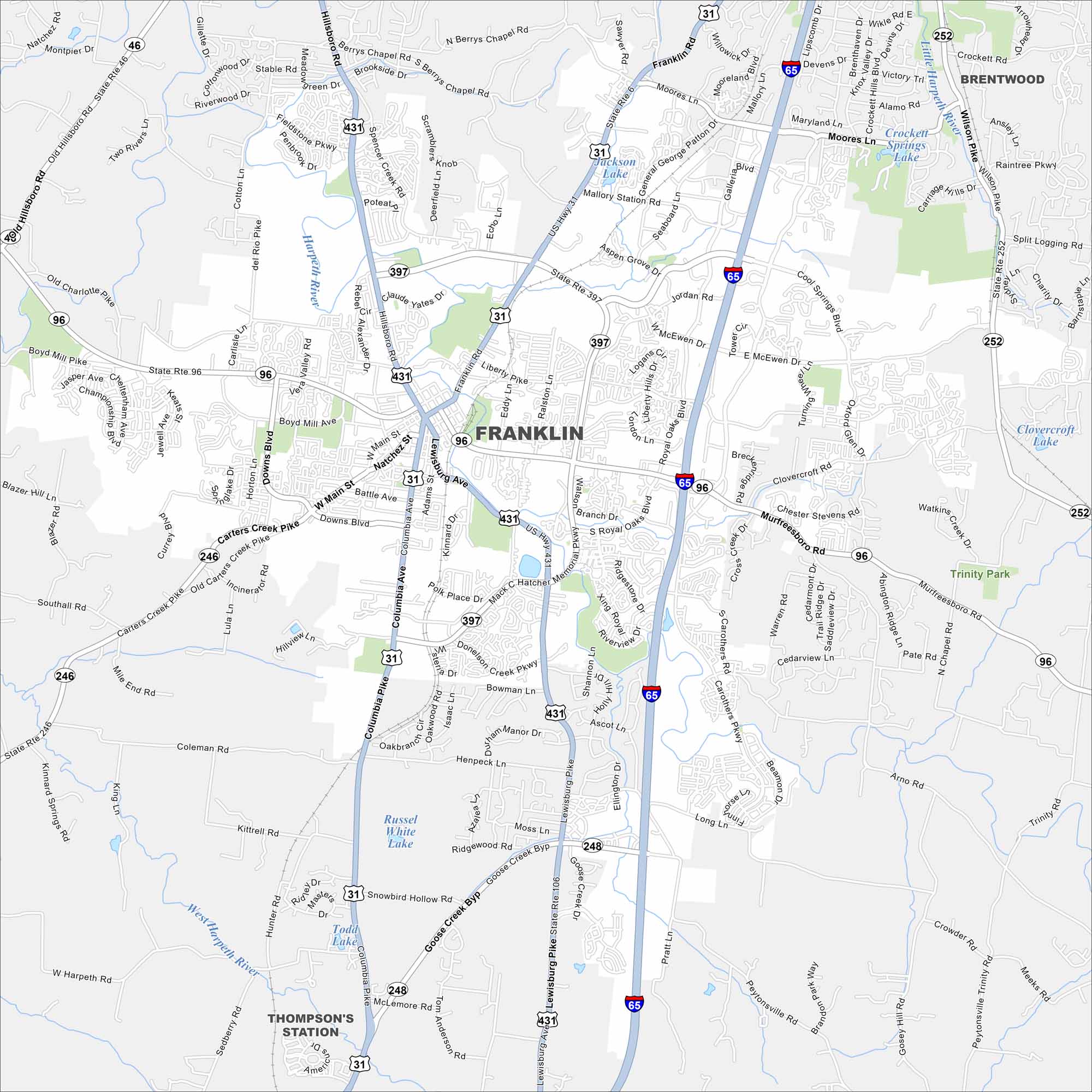
Franklin, Tennessee is south of Nashville with rolling hills and historic districts. The map shows I-65, which links it directly to the metro area. It’s also widely known for its Civil War history.
Map Information
On the Map
Interstates/Highways: I-65, US Hwy 31, US Hwy 431, State Rte 6, State Rte 46, State Rte 96, State Rte 106, State Rte 246, State Rte 248, State Rte 252, State Rte 397, State Rte 431 Major Roads: Main St, Mack Hatcher Memorial Pkwy, Hillsboro Rd, Columbia Ave, Murfreesboro Rd, Cool Springs Blvd, Franklin Rd, Lewisburg Pike, Goose Creek Byp, Wilson Pike, Royal Oaks Blvd, McEwen Dr, Liberty Pike, Boyd Mill Ave, Carters Creek Pike, Natchez St, Battle Ave, Downs Blvd, Westview Dr, Mallory Ln Lakes and Reservoirs: Russel White Lake, Todd Lake, Jackson Lake, Crockett Hills Blvd Lake, Clovercroft Lake Major Rivers: Harpeth River, West Harpeth River Parks and Preserves: Trinity Park Nearby Communities: Franklin, Brentwood, Thompson’s StationTennessee State Maps
Here are our state maps of Tennessee.


City Maps of Tennessee
Explore our Tennessee map collection


