Map of Green Bay, Wisconsin
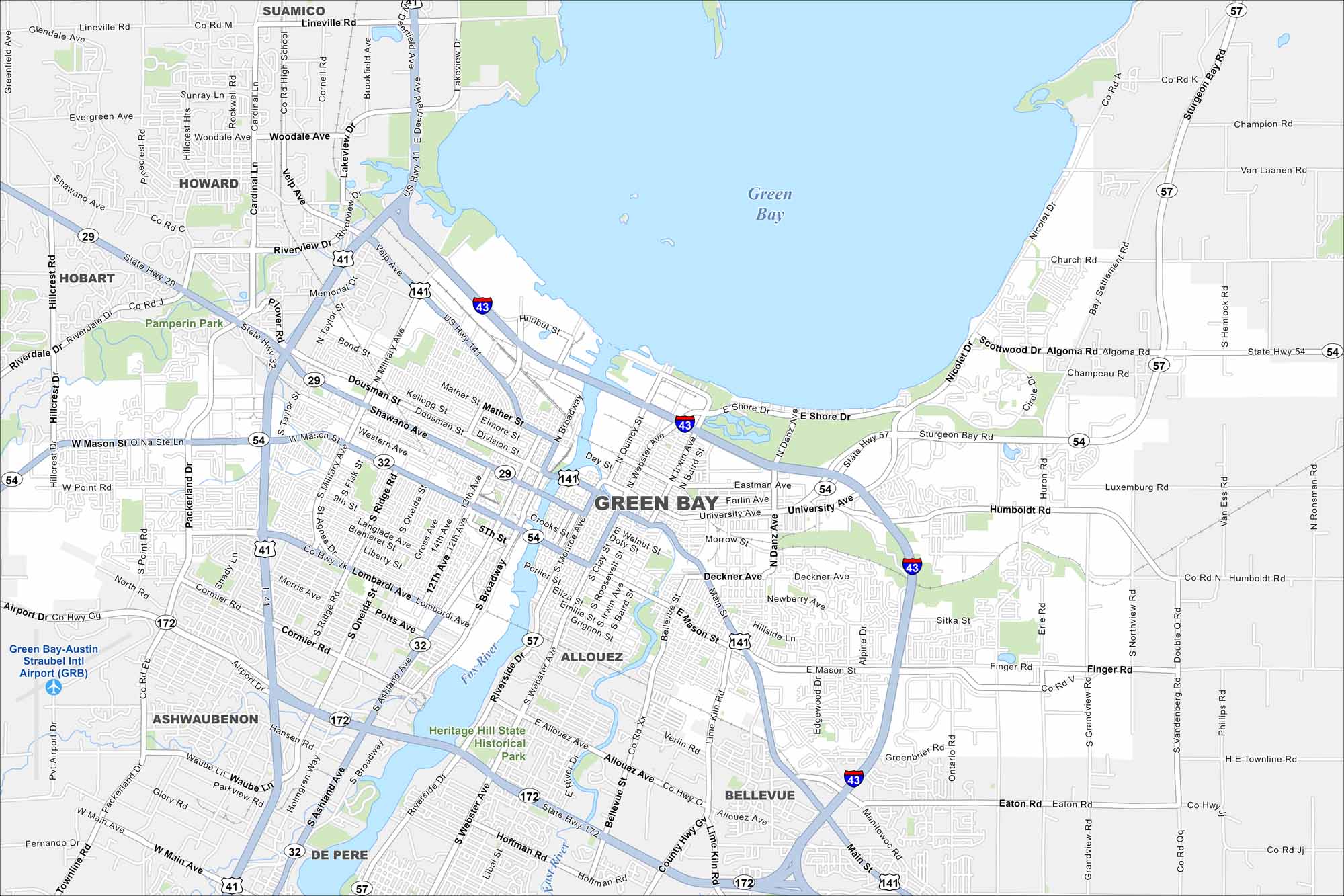
Our map of Green Bay shows it at the mouth of the Fox River. The bay of Lake Michigan defines its geography. But I’ve gotta say that the Green Bay Packers is the lifeblood of this city.
Map Information
On the Map
Interstates/Highways: I-43, US Hwy 41, US Hwy 141, State Rte 29, State Rte 54, State Rte 57, State Rte 32, State Rte 172 Major Roads: Mason St, Main St, University Ave, Military Ave, Webster Ave, Broadway, Ashland Ave, Taylor St, Velp Ave, Lineville Rd, Humboldt Rd, Finger Rd, Eaton Rd, Bellevue St, Oneida St, Ridge Rd, Dousman St, Shawano Ave, Mather St, Deckner Ave Airports: Green Bay-Austin Straubel Intl Airport Lakes and Reservoirs: Green Bay Major Rivers: Fox River, East River Parks and Preserves: Pamperin Park, Heritage Hill State Historical Park Nearby Communities: Ashwaubenon, Allouez, De Pere, Bellevue, Howard, Hobart, SuamicoWisconsin State Maps
Discover maps of the Badger State.


City Maps of Wisconsin
See our Wisconsin maps designed for clarity.


