Map of Greenfield, Wisconsin
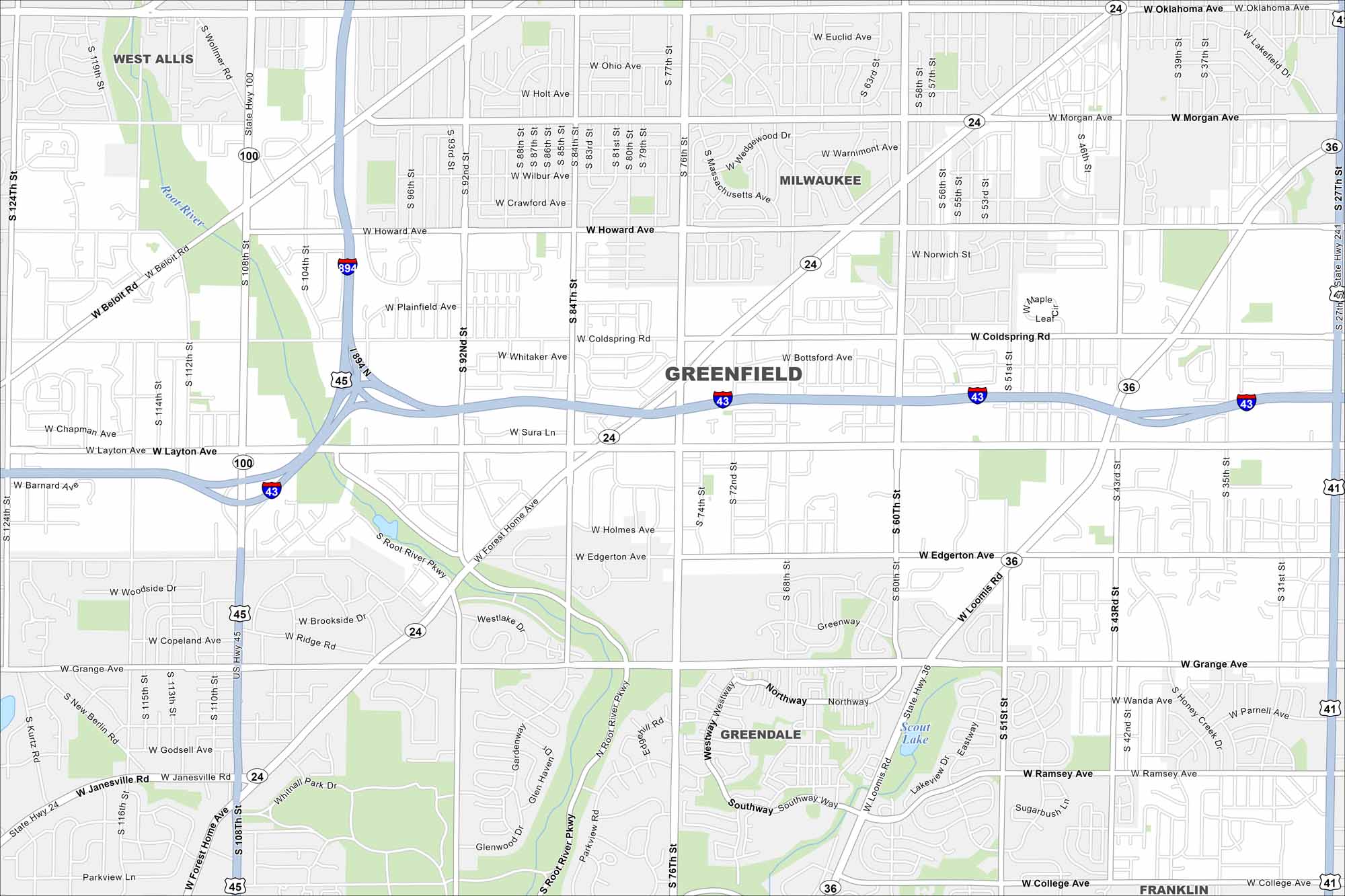
Our map of Greenfield highlights its spot south of Milwaukee. The street layout mixes older subdivisions with newer ones. Major roads run straight into downtown Milwaukee.
Map Information
On the Map
Interstates/Highways: I-43, I-894, US Hwy 45, State Rte 100, State Rte 36, State Rte 24, State Rte 241 Major Roads: 27th St, 108th St, 76th St, 60th St, Layton Ave, Forest Home Ave, Loomis Rd, 92nd St, 84th St, Beloit Rd, Morgan Ave, Howard Ave, Edgerton Ave, Grange Ave, Coldspring Rd, Oklahoma Ave, 124th St, Janesville Rd, 51st St, 43rd St Lakes and Reservoirs: Scout Lake Major Rivers: Root River Nearby Communities: Greendale, West Allis, Milwaukee, FranklinWisconsin State Maps
Discover maps of the Badger State.


City Maps of Wisconsin
See our Wisconsin maps designed for clarity.


