Map of Hawthorne, California
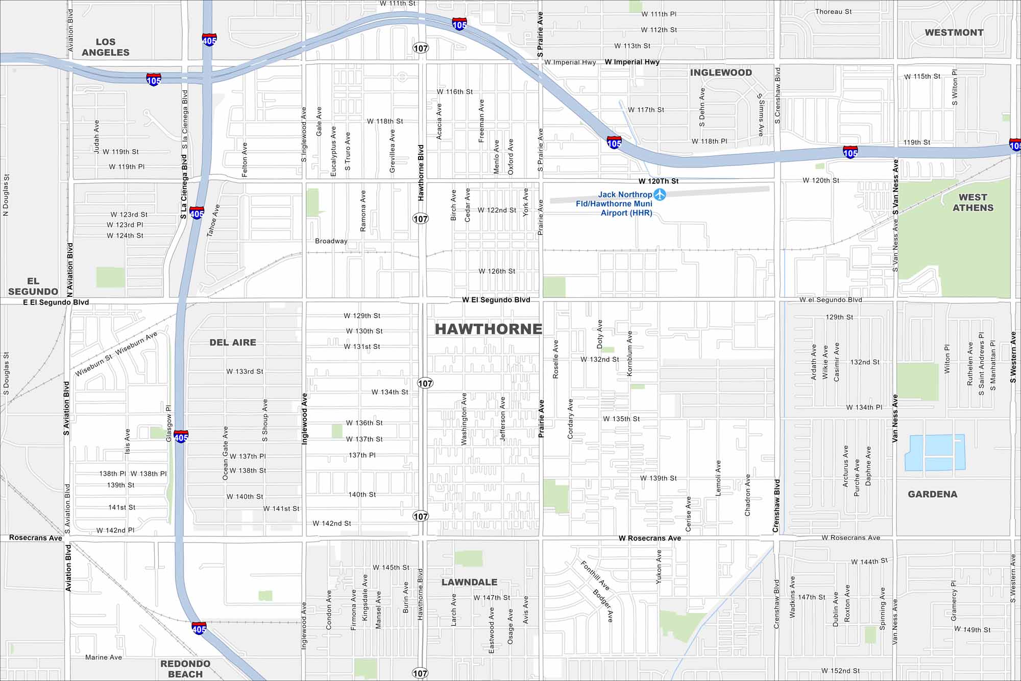
Hawthorne lies in Los Angeles County, just inland from the coast. On our map, you’ll see it boxed in by major freeways. The city is close to both LAX and the Pacific Coast.
California State Maps
Explore California with our state maps


Map Information
On the Map
Interstates/Highways: I-405, I-105, State Rte 107 Major Roads: Rosecrans Ave, Hawthorne Blvd, El Segundo Blvd, Imperial Hwy, Crenshaw Blvd, Aviation Blvd, Inglewood Ave, Prairie Ave, Van Ness Ave, Western Ave, Marine Ave, Broadway, W 120th St, W 135th St, W 147th St, Manhattan Pl, Wilton Pl, Gramercy Pl, Budlong Ave, Halldale Ave Airports: Jack Northrop Fld/Hawthorne Muni Airport (HHR) Nearby Communities: Los Angeles, Inglewood, Westmont, West Athens, Gardena, Lawndale, Redondo Beach, Del Aire, El SegundoCalifornia City Maps
Here are detailed maps of California


