Map of Hendersonville, Tennessee
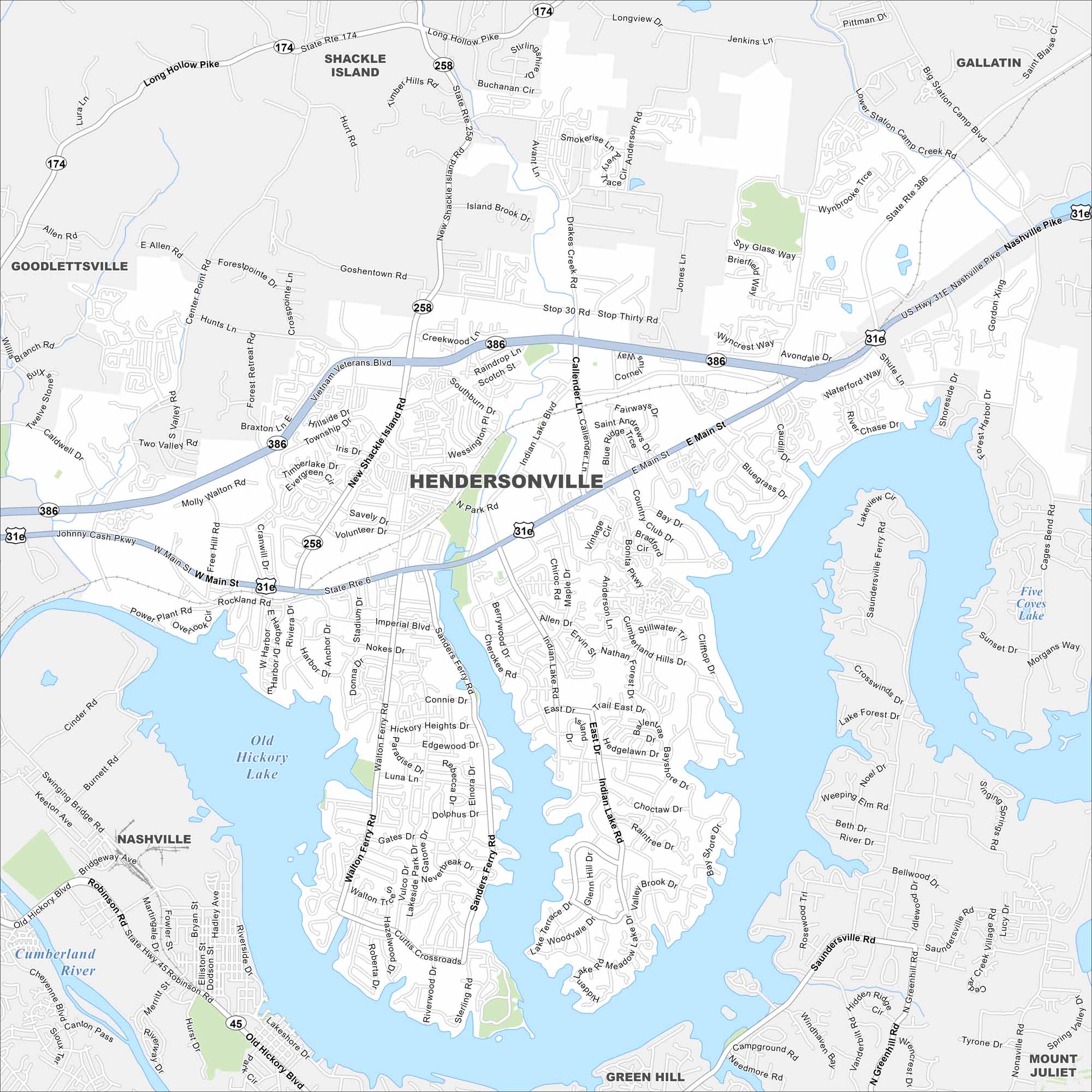
Explore our map of Hendersonville along the shores of Old Hickory Lake. Its roads spread north of Nashville. Water and highways are both key features here.
Map Information
On the Map
Interstates/Highways: US Hwy 31E, State Rte 6, State Rte 45, State Rte 174, State Rte 258, State Rte 386 Major Roads: Main St, Johnny Cash Pkwy, Vietnam Veterans Blvd, Gallatin Pike, Old Hickory Blvd, New Shackle Island Rd, Saundersville Rd, Indian Lake Blvd, Center Point Rd, Free Hill Rd, Rockland Rd, Sanders Ferry Rd, Walton Ferry Rd, Imperial Blvd, Stop 30 Rd, Forest Park Blvd, Bluegrass Dr, Main St East, Avondale Dr, Drakes Creek Rd Airports: Old Hickory Lake, Five Coves Lake Major Rivers: Cumberland River Nearby Communities: Hendersonville, Nashville, Goodlettsville, Shackle Island, Gallatin, Mount Juliet, Green HillTennessee State Maps
Here are our state maps of Tennessee.


City Maps of Tennessee
Explore our Tennessee map collection


