Map of Hermosa Beach, California
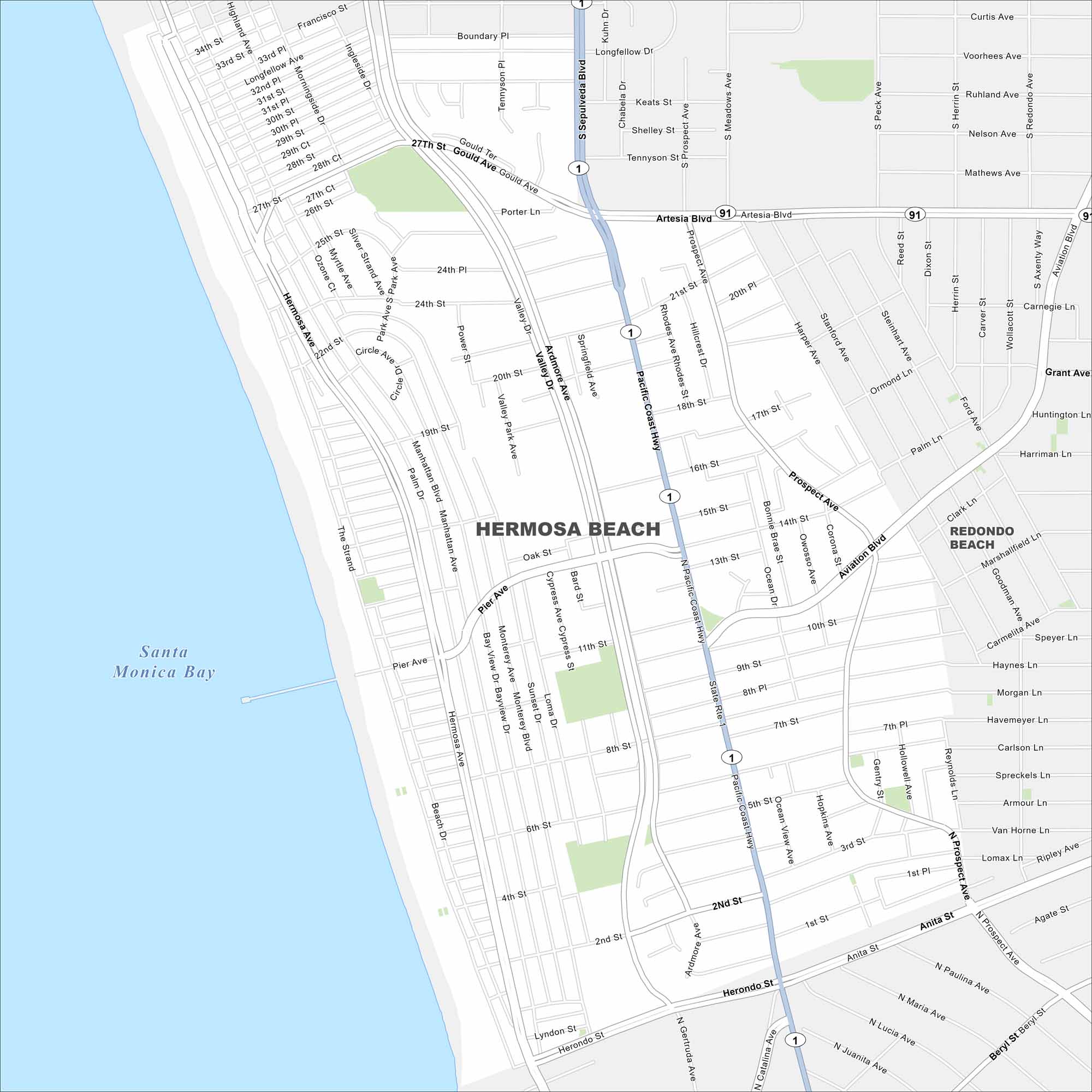
Hermosa Beach sits on the Southern California coast between Manhattan Beach and Redondo Beach. This map shows its location lined by the Pacific shoreline. The Pacific Coast Highway (SR 1) cuts nearby.
California State Maps
Explore California with our state maps


Map Information
On the Map
Interstates/Highways: State Rte 1, State Rte 91, Pacific Coast Hwy Major Roads: Artesia Blvd, Aviation Blvd, Sepulveda Blvd, Hermosa Ave, Manhattan Ave, Valley Dr, Prospect Ave, Pier Ave, 190th St, Herondo St, Anita St, Beryl St, Gould Ave, 27th St, 33rd St, Morningside Dr, Ardmore Ave, Golden Lantern St, Flagler Ln Lakes and Reservoirs: Santa Monica Bay Nearby Communities: Redondo BeachCalifornia City Maps
Here are detailed maps of California


