Map of Hesperia, California
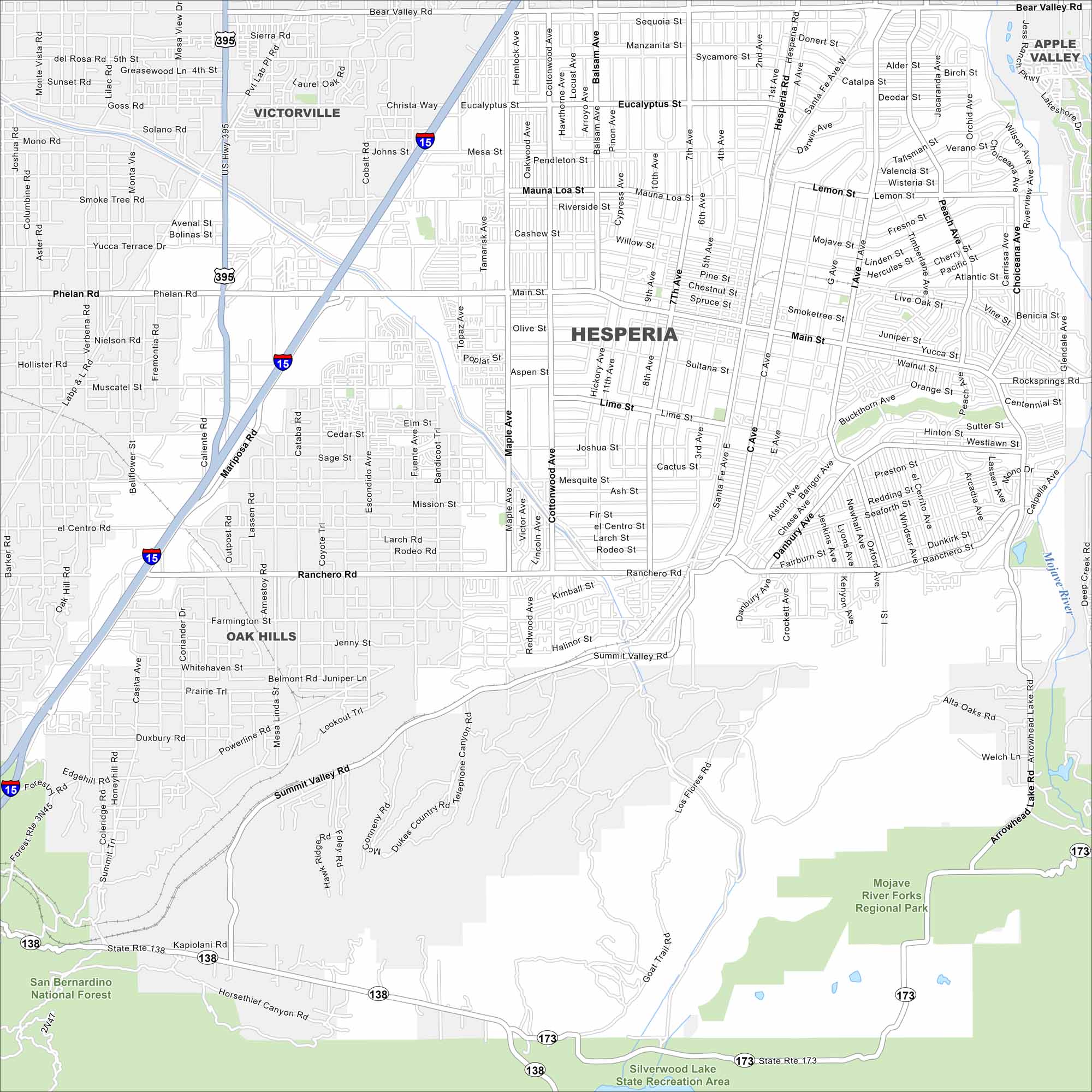
Hesperia lies in the Mojave Desert north of the San Bernardino Mountains. This map shows Interstate 15 running through the city. Beyond that, open desert stretches in all directions.
California State Maps
Explore California with our state maps


Map Information
On the Map
Interstates/Highways: I-15, US Hwy 395, State Rte 138, State Rte 173 Major Roads: Main St, Bear Valley Rd, Ranchero Rd, Summit Valley Rd, Hesperia Rd, Mariposa Rd, Phelan Rd, Mesa St, Eucalyptus St, Joshua St, Muscatel St, Farmington St, Maple Ave, Cottonwood Ave, I St, 7th Ave, 11th Ave, Topaz Ave, Escondido Ave, Caliente Rd Airports: Silverwood Lake Major Rivers: Mojave River Parks and Preserves: San Bernardino National Forest, Mojave River Forks Regional Park, Silverwood Lake State Recreation Area Nearby Communities: Victorville, Apple Valley, Oak HillsCalifornia City Maps
Here are detailed maps of California


