Map of Howard, Wisconsin
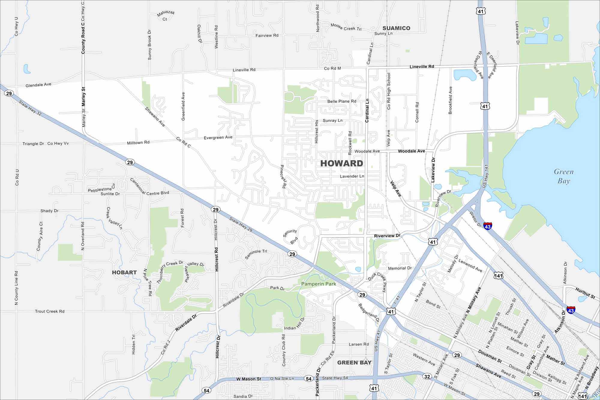
Howard sits along the bay near Green Bay itself. The map shows residential areas mixed with open land. Highways connect it straight into the city.
Map Information
On the Map
Interstates/Highways: I-43, US Hwy 41, US Hwy 141, State Rte 29, State Rte 32, State Rte 54 Major Roads: Velp Ave, Military Ave, Lineville Rd, Taylor St, Mason St, Shawano Ave, Riverview Dr, Cardinal Ln, Woodale Ave, Packerland Dr, Hillcrest Dr, Mather St, Dousman St, Western Ave, Bond St, Atkinson Dr, Marley St Lakes and Reservoirs: Green Bay Parks and Preserves: Pamperin Park Nearby Communities: Green Bay, Hobart, SuamicoWisconsin State Maps
Discover maps of the Badger State.


City Maps of Wisconsin
See our Wisconsin maps designed for clarity.


