Map of Jackson, Tennessee
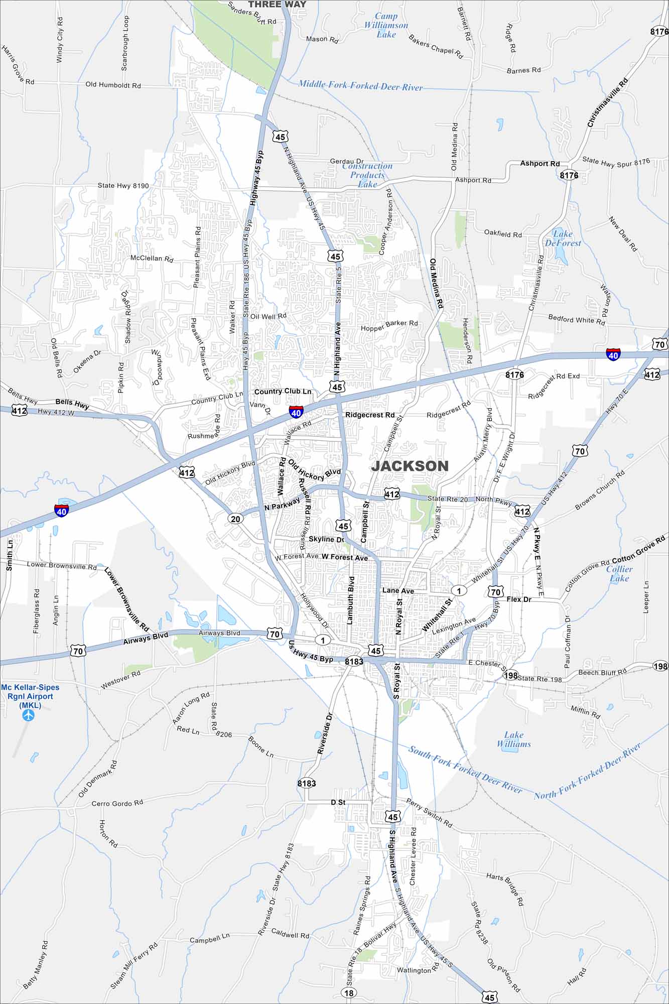
Get to know Jackson, which sits along I-40 in western Tennessee. This map shows rail lines and highways meeting in the city. Suburban neighborhoods spread into open farmland.
Map Information
On the Map
Interstates/Highways: I-40, US Hwy 45, US Hwy 70, US Hwy 412, State Rte 1, State Rte 5, State Rte 18, State Rte 20, State Rte 186, State Rte 198, State Rte 238 Major Roads: Highland Ave, North Pkwy, South Pkwy, Airways Blvd, Old Hickory Blvd, US Hwy 45 Byp, US Hwy 412 Byp, Whitehall St, Royal St, Campbell St, Riverside Dr, Forest Ave, Hollywood Dr, Wallace Rd, Christmasville Rd, Old Medina Rd, Ashport Rd, Dr. F.E. Wright Dr, Ridgecrest Rd, Oil Well Rd Airports: Mc Kellar-Sipes Rgnl Airport (MKL) Lakes and Reservoirs: Lake Williams, Lake DeForest, Camp Williamson Lake Major Rivers: South Fork Forked Deer River, Middle Fork Forked Deer River Nearby Communities: Three WayTennessee State Maps
Here are our state maps of Tennessee.


City Maps of Tennessee
Explore our Tennessee map collection


