Map of Janesville, Wisconsin
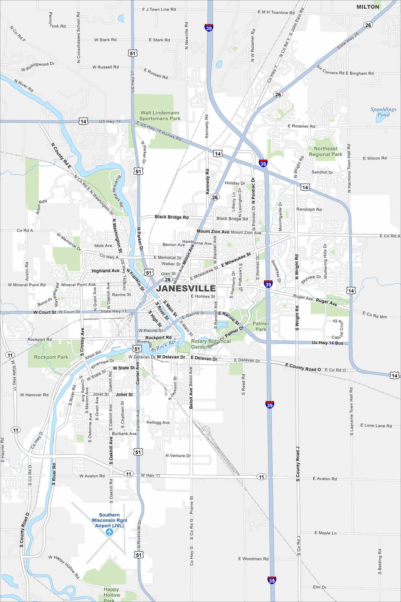
Janesville is built along the Rock River. The map shows parks and trails running beside the water. Highways connect it to Madison and Rockford.
Map Information
On the Map
Interstates/Highways: I-39, US Hwy 14, US Hwy 51, State Rte 26, State Rte 11 Major Roads: Milton Ave, Main St, Wright Rd, Court St, Center Ave, Washington St, Milwaukee St, Racine St, Delavan Dr, Humes Rd, Pontiac Dr, Kennedy Rd, Rotamer Rd, Avalon Rd, Crosby Ave, Oakhill Ave, Beloit Ave, Read Rd, Ruger Ave, Mineral Point Rd Airports: Southern Wisconsin Rgnl Airport Lakes and Reservoirs: Spauldings Pond Major Rivers: Rock River Parks and Preserves: Rockport Park, Palmer Park, Rotary Botanical Gardens, Northeast Regional Park, Walt Lindemann Sportsmans Park, Happy Hollow Park Nearby Communities: MiltonWisconsin State Maps
Discover maps of the Badger State.


City Maps of Wisconsin
See our Wisconsin maps designed for clarity.


