Map of Kenosha, Wisconsin
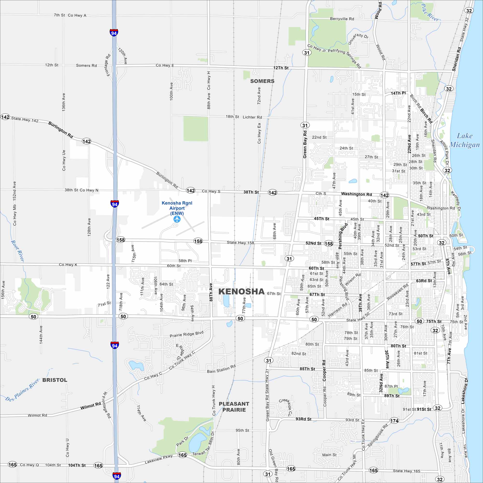
Kenosha sits along Lake Michigan’s shoreline. This map shows the road network east to the waterfront. Highways stretch north toward Milwaukee and south to Chicago.
Map Information
On the Map
Interstates/Highways: I-94, State Rte 158, State Rte 50, State Rte 31, State Rte 32, State Rte 142, State Rte 165, State Rte 174 Major Roads: 75th St, 60th St, 80th St, Washington Rd, Green Bay Rd, Sheridan Rd, 22nd Ave, 39th Ave, 30th Ave, 52nd St, 85th St, 93rd St, Pershing Blvd, 122nd Ave, 47th Ave, 14th Ave, 7th St, Main St, Lakeshore Dr, Burlington Rd Airports: Kenosha Rgnl Airport Lakes and Reservoirs: Lake Michigan Major Rivers: Pike River, Des Plaines River, Root River Nearby Communities: Pleasant Prairie, Somers, BristolWisconsin State Maps
Discover maps of the Badger State.


City Maps of Wisconsin
See our Wisconsin maps designed for clarity.


