Map of Kingsport, Tennessee
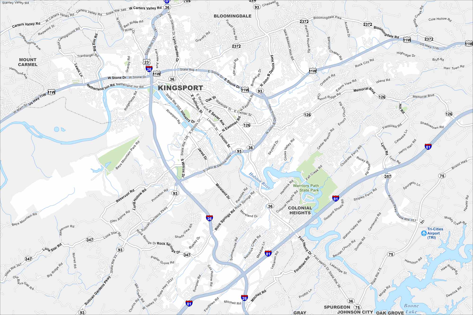
Kingsport is laid out along the Holston River. Our map shows winding roads leading into the Appalachian foothills. Industry and rail lines hug the riverbanks.
Map Information
On the Map
Interstates/Highways: I-26, I-81, US Hwy 11w, US Hwy 421, State Rte 1, State Rte 36, State Rte 75, State Rte 93, State Rte 126, State Rte 346, State Rte 347, State Rte 355, State Rte 357 Major Roads: Stone Dr, Eastman Rd, Center St, John B Dennis Hwy, Wilcox Dr, Fort Henry Dr, Rock Springs Rd, Sullivan Gardens Pkwy, Moreland Rd, Memorial Blvd, Netherland Inn Rd, Lynn Garden Dr, Bloomingdale Pike, Industry Dr, Sevier Ave, Wadlow Gap Rd, Carters Valley Rd, Airport Pkwy, Fall Creek Rd, Shipley Ferry Rd Airports: Tri-Cities Airport (TRI) Lakes and Reservoirs: Boone Lake Major Rivers: Holston River, North Holston River Parks and Preserves: Warriors Path State Park Nearby Communities: Mount Carmel, Bloomingdale, Colonial Heights, Gray, Spurgeon, Oak GroveTennessee State Maps
Here are our state maps of Tennessee.


City Maps of Tennessee
Explore our Tennessee map collection


