Map of La Mesa, California
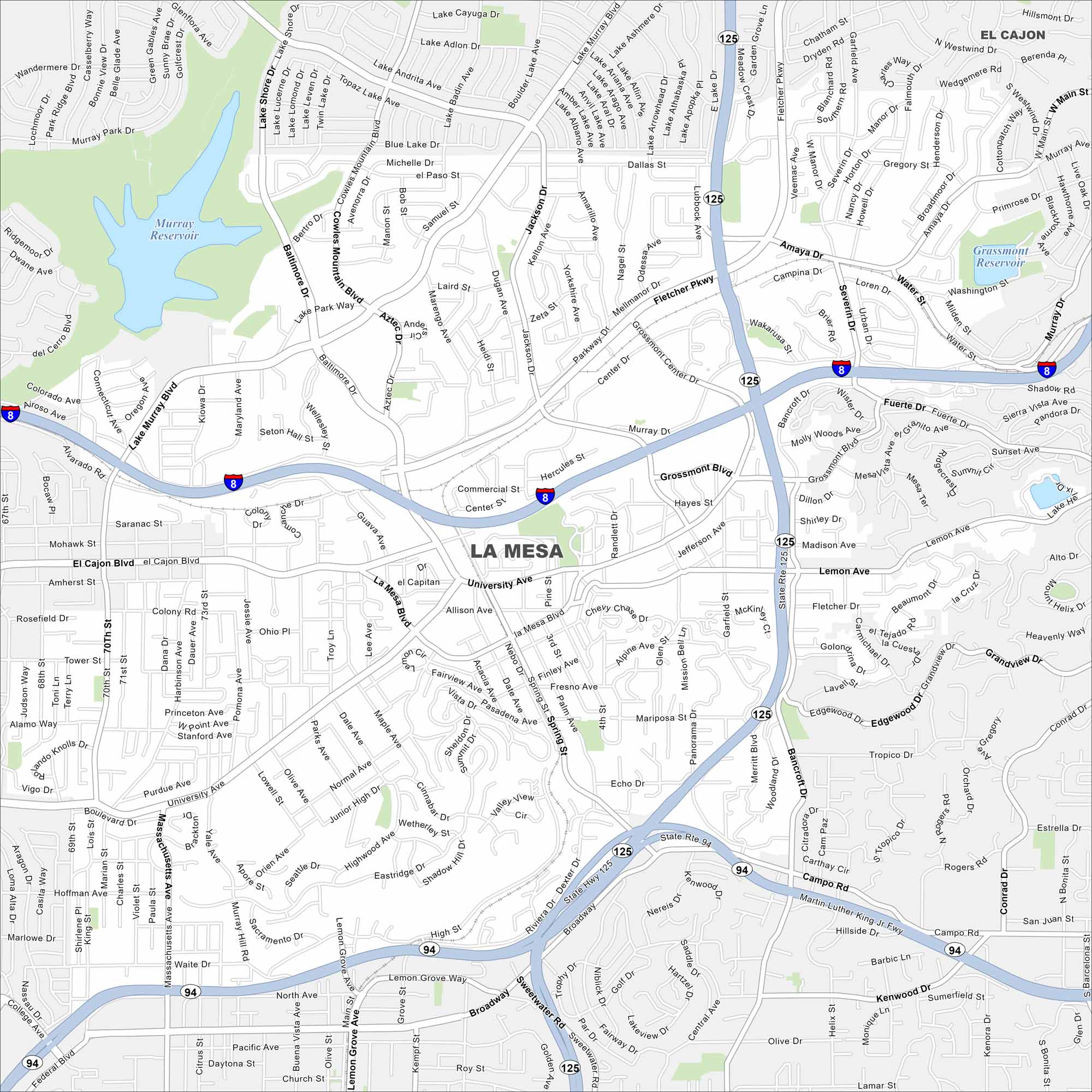
La Mesa is situated east of San Diego. Our map shows streets climbing gently toward nearby hills. Parks and small lakes cover the city.
California State Maps
Explore California with our state maps


Map Information
On the Map
Interstates/Highways: I-8, State Rte 125, State Rte 94 Major Roads: El Cajon Blvd, University Ave, La Mesa Blvd, Fletcher Pkwy, Grossmont Blvd, Lake Murray Blvd, Massachusetts Ave, Spring St, Amaya Dr, Lemon Grove Ave, Bancroft Dr, Campo Rd, Murray Dr Lakes and Reservoirs: Murray Reservoir, Grassmont Reservoir Nearby Communities: El Cajon, Lemon GroveCalifornia City Maps
Here are detailed maps of California


